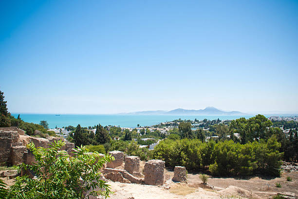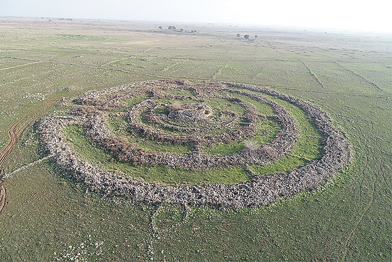
For decades, a massive, silent arrangement of basalt fieldstones sat on the high plateaus of the Golan Heights, baffling every explorer who climbed its ridges. Known as Rujm el-Hiri, the site earned the nickname “Israel’s Stonehenge” because of its sheer scale and mysterious purpose. It appeared to be a lonely titan, a singular architectural anomaly rising out of the rugged earth without a neighbor in sight. To the naked eye and the traditional archaeologist’s spade, it was a one-of-a-kind relic of a vanished world. But as it turns out, the ground was hiding a much larger secret, one that only became visible when we stopped looking at the dirt and started looking from the stars.
New research led by Ben-Gurion University of the Negev (BGU) has fundamentally shattered the idea that this monument was an isolated fluke. By pulling back the camera to a planetary scale, a team of scientists discovered that Rujm el-Hiri was actually the crown jewel of a sprawling, interconnected network of stone structures. It wasn’t a lonely temple; it was the centerpiece of a sophisticated regional tradition that stretched across the landscape, hidden in plain sight for millennia.
The Eye in the Sky Reveals the Invisible
The breakthrough didn’t come from a new excavation trench, but from high-resolution satellite photography and remote sensing technology. The terrain of the region is notoriously difficult to survey on foot, hindered by rugged terrain and complex geopolitical constraints. For years, these factors acted as a veil, keeping the full scope of the ancient landscape obscured. To pierce through this curtain, the research team—including experts from the University of Luxembourg, Tel Aviv University, and the Israel Antiquities Authority—turned to the sky.
By analyzing satellite imagery captured across different seasons, lighting conditions, and vegetation states, the researchers began to see patterns that are invisible from the ground. Vegetation grows differently over buried stone walls than it does over open soil, and the low sun of a winter morning casts long shadows that reveal the faint outlines of enclosures and field walls. This digital archaeology allowed the team to map out at least 28 additional large stone circles that had never been documented. Suddenly, the “Stonehenge” of the Levant had dozens of siblings scattered across the heights.
A Language Written in Basalt
As the data poured in, a consistent architectural theme began to emerge. These weren’t random piles of rock; they were deliberate, massive structures, many of which exceeded 50 meters in diameter. Built from the local basalt, the circles featured a recurring design of circular walls and internal partitions. This was a shared architectural language used by the people of the proto-historic Levant, suggesting a level of social organization that historians are only beginning to grasp.
The discovery shifted the perspective of the researchers, led by Dr. Michal Birkenfeld and Prof. Lev Appelbaum. They realized these structures weren’t just scattered randomly; they were strategically integrated into the environment. The vast majority were located near seasonal water sources, tucked into agricultural-pastoral land-use networks. They weren’t just monuments to the dead or the gods; they were functional parts of a living landscape, tied to the way ancient people managed their animals and their crops.
Mapping the Rhythm of Ancient Life
The presence of these 28 new sites suggests that the entire region was once a hive of coordinated activity. The researchers now believe these stone circles served a variety of vital roles for herding communities. They may have acted as ritual gathering places, where scattered tribes met at specific times of the year, or as territorial markers that signaled ownership of grazing lands. They could even have served as seasonal assembly sites, points on a map where people converged to trade, celebrate, or move their livestock.
By placing Rujm el-Hiri back into this context, it loses its status as a “mysterious anomaly” and gains a much more interesting identity as a magnificent example of a regional phenomenon. It was likely the grandest version of a structure that everyone in the region recognized and used. This landscape-based perspective reveals a society that was highly mobile yet deeply rooted in its geography, using these basalt monuments to anchor their social and economic systems to the earth.
Why the Secrets of the Stones Matter Today
This research is about more than just finding old rocks; it represents a revolution in how we reconstruct the shared human past. By combining surface geophysical methods with tectonic-morphological methodologies, scientists are proving that even well-trodden ground like the territory of Israel still holds profound secrets. The “invisible” archaeological record is finally being read, showing us that ancient populations were far more sophisticated in their resource management and regional coordination than we once assumed.
Understanding these integrated cultural landscapes helps us see the long-term history of human interaction with the environment. It proves that even in the proto-historic era, humans weren’t just surviving in nature—they were engineering it, creating vast networks of stone and water that dictated the flow of life for centuries. As we use advanced remote sensing to uncover more of these hidden patterns, we move closer to a full understanding of how our ancestors built the foundations of the modern world, one stone circle at a time.
Study Details
Michal Birkenfeld et al, Reassessing Rujm el-Hiri: Aerial imagery and stone circles in the proto-historic Southern Levant, PLOS One (2026). DOI: 10.1371/journal.pone.0339952