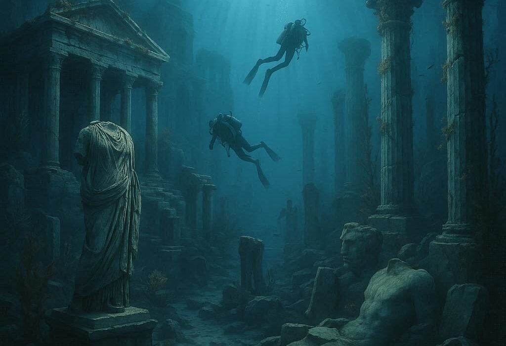
Beneath the world’s oceans, lakes, and rivers lie the remains of ancient settlements, shipwrecks, trading vessels, and other traces of human activity. Some have rested underwater for thousands of years, preserved by conditions that would have destroyed similar objects on land. Others reveal evidence of disasters, lost technologies, changing coastlines, and the connections that once linked distant civilizations.
Underwater archaeology is the scientific study of human history through material remains found beneath the water. It combines archaeological investigation with marine science, surveying, conservation, and specialized diving or remote-sensing technology. Its purpose is not simply to recover objects from the seabed, but to understand how people lived, traveled, traded, built communities, and interacted with their environments.
These submerged sites offer a distinctive perspective on the past. A shipwreck can preserve an entire cargo alongside the equipment used by its crew. An inundated settlement can reveal how people adapted to a changing landscape. Even a seemingly ordinary fragment of pottery can help researchers reconstruct ancient trade networks or identify where a vessel began its journey.
What underwater archaeology reveals about the past
Underwater archaeology examines physical evidence left behind by human activity in submerged environments. Although shipwrecks are among its best-known subjects, the field encompasses much more than sunken vessels. Researchers investigate prehistoric settlements now covered by rising seas, ancient harbor facilities, submerged religious structures, fishing installations, military remains, and landscapes that were once dry land.
The distinction between underwater archaeology and the broader study of the ocean is important. Marine scientists investigate the physical, chemical, and biological processes of aquatic environments, while underwater archaeologists focus on interpreting evidence of human behavior. The disciplines often overlap because understanding a site’s natural history is essential to interpreting its archaeological remains.
For example, a collection of wooden timbers on the seabed might initially appear to be the remains of a ship. Careful investigation could reveal that the timbers belong to a harbor structure, a fishing installation, or a building from a settlement that was later flooded. Their arrangement, construction methods, associated artifacts, and relationship to the surrounding landscape help determine what the site represents.
Archaeologists also distinguish between an object’s historical value and its scientific value. A gold coin may attract attention, but a common ceramic fragment can be more informative if its composition identifies a manufacturing center or establishes a connection between two regions. The location of an object relative to other remains can be equally significant.
This emphasis on context is fundamental to archaeology. An artifact removed without recording its position may lose much of the information that makes it useful. Underwater archaeology therefore seeks to document relationships among objects, structures, sediments, and the environment before deciding whether any material should be recovered.
How archaeological sites end up underwater
Submerged archaeological sites form through several natural and human processes. Some result from gradual environmental changes, while others are associated with sudden disasters or deliberate human activity.
One of the most important processes is sea-level change. During the last ice age, large quantities of Earth’s water were stored in continental ice sheets, leaving global sea levels substantially lower than they are today. Areas that now lie beneath shallow coastal seas were once exposed landscapes where people hunted, gathered food, established settlements, and traveled between regions.
As the ice sheets melted, sea levels rose and gradually inundated many of these environments. Some communities may have moved inland as shorelines advanced, while buildings, tools, hearths, and other traces of occupation became submerged. These drowned landscapes are valuable because they preserve evidence of human activity in places that would otherwise be difficult to investigate.
Sea-level rise is not the only cause of inundation. Tectonic activity can lower sections of the Earth’s crust, while earthquakes can trigger sudden changes in coastal terrain. Volcanic activity, landslides, erosion, and the collapse of riverbanks can also contribute to the submergence or destruction of settlements. In some locations, rivers change course or floodplains become lakes, placing former human settlements beneath water.
Shipwrecks form through a different set of circumstances. Vessels may sink during storms, collisions, battles, navigational errors, or structural failures. Some are deliberately scuttled, meaning they are intentionally sunk. Others are abandoned and gradually deteriorate before disappearing beneath sediment or water.
Not every submerged site is ancient, and not every shipwreck represents a catastrophe. A vessel may have been lost while carrying ordinary commercial goods, or its remains may have accumulated through repeated maritime activity. Archaeologists examine the physical evidence rather than assuming a dramatic story from the outset.
How underwater archaeologists locate submerged sites
Finding an archaeological site beneath water can be challenging because visibility is often limited, the seabed may cover important remains, and surveying large areas can be expensive. Researchers therefore combine historical research, remote sensing, underwater observation, and targeted excavation.
Historical documents can provide useful starting points. Shipping records, old maps, navigation charts, harbor plans, and accounts of maritime disasters may indicate where a vessel or settlement was located. These records are rarely complete, however, and historical descriptions may use landmarks that have since changed or disappeared.
Remote-sensing instruments help researchers investigate areas that divers cannot easily inspect. Sonar systems transmit sound waves and analyze the returning signals to map the seabed or identify objects resting on it. Side-scan sonar can produce detailed images of seabed features, while multibeam sonar measures water depth across a broad swath to create three-dimensional representations of underwater terrain.
Magnetometers detect variations in Earth’s magnetic field and can help identify iron objects or concentrations of ferrous material, such as anchors, cannon, and other metal components. Their usefulness depends on the composition of the target and the surrounding geology. A magnetometer cannot identify a shipwreck on its own; it detects an anomaly that requires further investigation.
Researchers may also use remotely operated vehicles, or ROVs, which are underwater machines controlled from the surface. Equipped with cameras, lights, and sometimes robotic arms, these vehicles can inspect deep or hazardous sites without placing divers in the water. Autonomous underwater vehicles can follow programmed survey routes and collect information across large areas.
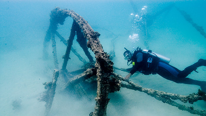
Once a promising location has been identified, archaeologists may use divers, remotely operated cameras, or other instruments to examine it more closely. They document visible remains, assess the site’s condition, and determine whether further investigation is justified.
Technology can reveal shapes and anomalies, but it cannot automatically establish archaeological significance. A sonar image might show a long, straight object that resembles a shipwreck, only for closer inspection to reveal a natural rock formation. Reliable interpretation depends on combining instrumental evidence with direct observation and archaeological reasoning.
How underwater excavations are conducted
Underwater excavation follows the same fundamental archaeological principles as excavation on land, but the surrounding water creates additional practical and scientific challenges. Currents can shift loose objects, poor visibility can make orientation difficult, and depth places limits on the time divers can safely work.
Before excavation begins, researchers establish a record of the site’s overall layout. They create maps, photographs, measurements, and, where appropriate, three-dimensional models. Individual artifacts and structures are recorded in relation to fixed reference points so their original positions can be reconstructed later.
Photogrammetry is one technique used for this work. It involves taking many overlapping photographs and processing them to produce accurate measurements or three-dimensional representations of a site. When photographs are properly captured and scaled, researchers can use the resulting model to examine details, compare features, and document a site without relying exclusively on physical drawings.
Excavation then proceeds systematically. Archaeologists may remove sediment in controlled layers, often using specialized water-powered suction devices known as dredges. These systems can help clear loose sediment, although their use must be carefully controlled to avoid damaging artifacts or destroying important evidence. Removed material may be collected or screened when small objects are likely to be present.
The order in which materials are deposited can reveal the history of a site. Archaeologists study stratigraphy, the arrangement of sediment and other deposits in layers. In undisturbed conditions, lower deposits are generally older than those above them, although currents, storms, animals, erosion, and human activity can disturb the sequence.
On a shipwreck, the distribution of cargo, personal possessions, structural components, and equipment can help researchers determine how the vessel was loaded and used. The position of broken timbers may provide evidence of structural failure, while the arrangement of objects can help distinguish a vessel’s original contents from material deposited after it sank.
Excavation is not always the best option. If a site is stable and protected, archaeologists may decide that mapping and monitoring will provide more value than removing material. Excavation permanently alters the relationships among objects and deposits, even when carried out carefully. Recording a site before disturbing it is therefore essential.
Why shipwrecks are unusually valuable historical records
A shipwreck can preserve a concentrated collection of evidence about a particular moment in maritime history. Unlike many land sites that have been occupied, rebuilt, and altered over centuries, some wrecks preserve cargo and equipment deposited during a single voyage.
The ship itself provides information about technology. Its hull shape, construction methods, fasteners, rigging components, and repairs can reveal how it was built and maintained. These details may help researchers identify a vessel’s cultural or regional origins and understand how shipbuilding practices changed over time.
Cargo offers another source of evidence. Ceramics, metals, foodstuffs, textiles, stone, and other goods can reveal what merchants transported, how goods were packaged, and which regions were connected by trade. When artifacts from different manufacturing centers occur together, their distribution can illuminate commercial relationships that written records describe only partially.
Personal objects may offer glimpses into daily life aboard a vessel. Cooking equipment, clothing fasteners, tools, games, and personal belongings can help researchers investigate how crews worked and lived. Such evidence should be interpreted cautiously: objects do not always identify their owners, and a wreck’s surviving contents rarely represent every aspect of life on board.
Shipwrecks also help researchers study the movement of ideas and technologies. Similar objects found in distant locations may indicate trade, migration, or cultural exchange. Differences in construction and cargo can reveal regional preferences or changes in maritime practice.
The sinking itself can leave a record of the final moments of a voyage, but that record is not always straightforward. Cargo may shift as a vessel founders, currents can scatter objects, and later salvage can remove valuable material. Archaeologists must distinguish evidence of the original wrecking event from changes that occurred afterward.
Discoveries that have changed our understanding of history
Several well-known underwater discoveries demonstrate how submerged sites can transform historical understanding.
The Uluburun shipwreck, discovered off the southern coast of present-day Turkey, dates to the Late Bronze Age, around the 14th century BCE. Its cargo included copper and tin ingots, glass, pottery, and other goods associated with long-distance exchange across the eastern Mediterranean. The assemblage provides evidence of the scale and complexity of trade during a period when societies depended on maritime connections to obtain materials and finished products.
The wreck is especially valuable because its cargo represents more than one region and type of commodity. Its contents help researchers investigate how raw materials, luxury goods, and manufactured objects moved through interconnected commercial networks. They also demonstrate that Bronze Age maritime exchange was not simply a series of isolated local transactions.
The Antikythera shipwreck, found off the Greek island of Antikythera, is another major discovery. The wreck contained ancient statues, coins, and other artifacts, including the extraordinary Antikythera mechanism. This complex geared device was designed to represent astronomical cycles and predict certain celestial events. Its sophistication provides direct evidence of ancient mechanical engineering and mathematical knowledge that would otherwise be difficult to reconstruct from surviving texts alone.
The mechanism also illustrates why underwater discoveries can challenge assumptions about technological history. A surviving object can demonstrate what craftspeople were capable of producing, even when few comparable examples have survived. It does not, by itself, reveal how widespread that technology was or exactly how its knowledge was transmitted.
The discovery of the Titanic wreck in 1985 brought renewed attention to deep-sea exploration and the preservation of modern shipwrecks. Located in the North Atlantic, the wreck provided an opportunity to document the remains of a vessel whose sinking in 1912 had been extensively recorded. Photographs and surveys revealed the ship’s condition on the seabed and helped researchers examine how it had deteriorated after sinking.
Titanic also illustrates the difference between a famous historical object and a scientifically informative site. The wreck’s position, the separation of its major sections, the distribution of debris, and the effects of the deep-sea environment all contribute to understanding its physical history. Its importance extends beyond its cultural prominence to include questions about materials, corrosion, deep-ocean conditions, and the long-term survival of human-made structures.
Submerged prehistoric landscapes offer a different kind of discovery. Sites beneath shallow seas can preserve evidence of people who occupied coastal regions before sea levels rose. These remains can help researchers reconstruct migration routes, settlement patterns, and the ways communities adapted to environmental change. Because such landscapes may now lie far offshore, locating them often requires broad geological surveys before archaeological evidence can be investigated.
Together, these discoveries show that underwater archaeology does not produce a single kind of historical insight. It can illuminate commerce, engineering, daily life, disaster, and human adaptation to changing environments.
How water preserves some artifacts and destroys others
Water is not automatically a preservative. Whether an artifact survives depends on several interacting factors, including temperature, oxygen availability, salinity, sediment, water movement, and the material from which the object is made.
Wood provides a particularly clear example. On land, exposed wood is vulnerable to fungi, insects, and changing moisture conditions. Underwater, wood buried in sediment with little available oxygen may deteriorate more slowly because many organisms responsible for decomposition require oxygen. Cold conditions can further slow some biological processes.
However, submerged wood is not necessarily stable. Marine organisms such as shipworms can damage wooden structures, while bacteria and other microorganisms can gradually break down the material. Wood exposed to oxygenated water may deteriorate differently from wood buried in low-oxygen sediment. The same shipwreck can therefore contain well-preserved timbers in one area and severely degraded wood in another.
Metals respond differently. Iron corrodes through chemical reactions involving water and oxygen, with the rate and pattern of deterioration influenced by salinity, temperature, sediment, and local chemistry. Copper alloys can develop corrosion products that sometimes form relatively stable surface layers, although this does not mean they are immune to damage. Gold is comparatively resistant to corrosion, which helps explain why gold objects can survive in environments that seriously damage other materials.
Ceramics, stone, and glass may survive for long periods, but they can still be altered by abrasion, chemical reactions, breakage, or biological growth. Repeated movement of sand can wear away surfaces, while changes in water chemistry can affect certain types of glass. Organic materials such as leather, rope, paper, and textiles are often especially vulnerable unless conditions limit the organisms and reactions that destroy them.
Sediment plays a major role in preservation. Burial can shield artifacts from currents, scavengers, and direct exposure to oxygenated water. Yet sediment is not always protective: shifting deposits can expose objects, and the movement of sediment can damage fragile surfaces or redistribute remains.
These differences explain why a wreck may preserve a remarkably intact cargo alongside badly deteriorated structural elements. They also explain why the appearance of an object on the seabed can be misleading. An artifact that looks solid may have a fragile internal structure or a chemically unstable surface.
What happens when artifacts are brought to the surface
Recovering an artifact is only the beginning of its conservation. An object that has remained underwater for centuries may be in chemical and physical equilibrium with its surroundings. Removing it from that environment can trigger rapid changes that cause serious damage.
Waterlogged wood, for example, may retain its external shape even after much of its original structural material has degraded. Water occupies spaces within the wood that once contained stronger cellular structures. If the wood dries without appropriate treatment, it can shrink, crack, or collapse.
Iron objects can also deteriorate rapidly after recovery. Corrosion products and salts accumulated during burial may react with oxygen and moisture in new ways. Changes in humidity can accelerate corrosion, making controlled storage and treatment essential.
Conservators therefore assess an object’s material composition, condition, and environmental history before selecting a treatment. Depending on the artifact, conservation may involve desalination, controlled drying, chemical stabilization, or the use of supporting materials to preserve its structure. Waterlogged wood may require specialized treatments to prevent collapse as water is removed.
Some treatments take months or years, and the best approach varies by material. There is no universal process that safely preserves every underwater artifact. A method appropriate for one type of metal may be unsuitable for another, while a fragile composite object may require several coordinated treatments.
Conservation also includes documentation and long-term care. Temperature, humidity, and other storage conditions may need continuous control. Museums and research institutions must consider not only how to stabilize an object initially but also how to maintain it for future study.
For this reason, archaeologists do not recover every object they discover. Leaving a stable artifact in place may be the most responsible decision when its removal would create unnecessary damage or when adequate conservation resources are unavailable.
The challenges of exploring deep water
Deep-sea archaeology is especially demanding because pressure, darkness, low temperatures, and distance from the surface complicate almost every stage of research. As depth increases, water pressure rises substantially, creating hazards for divers and requiring specialized equipment for remotely operated systems.
Human divers cannot work indefinitely at depth. Depending on depth and other conditions, dives may require careful control of ascent rates, decompression procedures, and limits on time spent underwater. Some archaeological sites lie beyond practical diving limits, making robotic systems essential.
ROVs allow researchers to inspect wrecks and collect detailed imagery while operators remain aboard a surface vessel. More advanced systems can carry measuring instruments, manipulate small objects, or collect samples under carefully controlled conditions. Their cameras can record areas that would be difficult or unsafe for human divers to reach.
Autonomous vehicles are useful for surveying broad areas because they can follow planned routes without continuous direct control. Their sensors can collect sonar, depth, and other environmental data, which researchers combine to identify features of interest. However, autonomous systems do not eliminate the need for interpretation, and detecting an object is not the same as establishing what it is.
Deep-water operations also demand substantial logistical support. Research vessels, navigation systems, specialized instruments, trained personnel, and reliable data processing are expensive. As a result, many projects must carefully prioritize which locations to investigate and which methods are most likely to answer meaningful research questions.
Despite these challenges, technological improvements have expanded the range of archaeological sites that can be studied. More accurate mapping, better imaging, and improved remote operations make it possible to document locations that were previously inaccessible or poorly understood. The most useful advances are those that improve the quality of evidence while reducing unnecessary disturbance.
How underwater archaeology contributes to science beyond history
Underwater archaeology sits at the intersection of several disciplines. Its findings can contribute to geology, climate science, materials research, biology, and the study of human responses to environmental change.
Submerged landscapes provide evidence about past shorelines and coastal environments. When researchers combine archaeological remains with sediment analysis, geological mapping, and sea-level records, they can investigate how coastlines changed and how human populations responded. Such evidence can help reconstruct the environments in which earlier communities lived, although a single site rarely provides a complete picture of regional change.
Shipwrecks can also function as records of past technology and resource use. The composition of metal objects, the origins of ceramic materials, and the design of wooden structures may reveal how people obtained raw materials and organized production. Scientific analysis can identify material properties or manufacturing practices that are difficult to determine through visual inspection alone.
Biological research may help explain how marine organisms colonize wrecks and alter submerged structures. Shipwrecks can become artificial habitats, attracting or supporting marine life, although their ecological effects vary with location, materials, and environmental conditions. Understanding these processes is important both for interpreting archaeological preservation and for assessing the changing condition of wreck sites.
Underwater archaeology can also help explain the consequences of natural hazards. Submerged settlements and damaged harbor structures may preserve evidence of earthquakes, coastal erosion, or flooding. Yet researchers must distinguish between the event that initially affected a site and the many environmental processes that altered it afterward.
These connections are particularly valuable because archaeological evidence records the interaction between human decisions and environmental conditions. A submerged harbor, for example, may reveal not only how people constructed maritime infrastructure but also how they responded to changes in sedimentation, shoreline position, or access to navigable water.
Protecting submerged cultural heritage
Underwater archaeological sites are vulnerable to both natural deterioration and human interference. Storms, currents, biological activity, and changing environmental conditions can damage remains over time. Human activities, including unauthorized salvage, anchoring, dredging, construction, and destructive fishing practices, can also disturb or destroy sites.
Looting presents a particular problem because it removes objects without preserving their archaeological context. A recovered artifact may retain some information about its manufacture or age, but its relationship to neighboring objects and surrounding deposits may be lost. When objects are dispersed through private collections, researchers may also lose the opportunity to study them systematically.
The commercial value of certain artifacts can encourage destructive recovery. Removing coins, ceramics, or other attractive objects while ignoring less visually impressive evidence may leave a site stripped of the information needed to reconstruct its history. Responsible archaeology treats the site as an interconnected body of evidence rather than a collection of saleable possessions.
Not every underwater site should be excavated or displayed. Some are best protected in place, particularly when they are stable and can be monitored without disturbance. Others may require documentation, controlled recovery, or physical protection because they face immediate threats. Decisions depend on scientific significance, preservation conditions, practical resources, and applicable legal protections.
Ownership and access can be complicated. A wreck may lie within a nation’s territorial waters, within an exclusive economic zone, or in international waters, and different legal rules may apply. Government agencies, Indigenous communities, descendant communities, museums, researchers, and other stakeholders may have legitimate interests in particular sites. Ethical practice requires attention to these interests as well as to the scientific value of the remains.
Public education is another important part of protection. Museums, digital models, research publications, and carefully designed exhibits can make underwater discoveries accessible without requiring the removal of every artifact. Digital documentation can preserve information about a site’s condition at a particular time, although it cannot replace the physical evidence itself.
The central principle is that submerged cultural heritage is a finite resource. Once a site is destroyed or its context lost, the original evidence cannot be fully recreated. Preserving sites and recording them carefully allows future researchers to ask questions that today’s investigators may not yet know how to formulate.
What the future holds for underwater archaeology
Underwater archaeology will continue to benefit from improvements in remote sensing, imaging, robotics, and digital analysis. More detailed sonar maps and higher-quality three-dimensional models can help researchers identify subtle structures, compare sites, and monitor deterioration over time. Better integration of archaeological, geological, and environmental data can also reveal relationships that are difficult to recognize from individual datasets.
Machine-learning systems may assist with tasks such as identifying potential wreck features in large sonar surveys or sorting extensive collections of images. These tools can help researchers focus their attention, but their results must be checked against reliable evidence. Automated pattern recognition cannot independently establish a site’s historical identity or replace archaeological interpretation.
Climate change presents additional challenges. Rising sea levels, coastal erosion, changing storm patterns, and shifts in ocean conditions may threaten some submerged sites, while sediment movement may expose others. The effects will vary by location, and not every archaeological site will respond in the same way. Monitoring is therefore important for identifying vulnerable locations and determining where intervention may be justified.
Future discoveries will not necessarily be the largest or most visually dramatic. A small cluster of tools, a section of ancient shoreline, or a fragment of a wooden structure may answer an important question about settlement, exchange, or technological change. The value of a discovery depends on the quality of its evidence and the questions it allows researchers to investigate.
Underwater archaeology ultimately expands the historical record by examining places where human activity has been preserved beneath water. It reveals not only what people made and carried but also how they adapted to changing coastlines, built maritime networks, and interacted with the environments around them. Careful investigation and conservation ensure that these submerged traces remain available for scientific study, helping future generations develop a more complete understanding of the human past.