Archaeologists from the University of Southampton have uncovered a massive timber structure buried beneath what appears today to be a stone-built island in a Scottish loch. The site, a crannog on Loch Bhorgastail in the Isle of Lewis, has been dated to more than 5,000 years ago, making it older than Stonehenge and revealing a complex, multi-phase construction history spanning millennia. Researchers also recovered hundreds of Neolithic pottery fragments, suggesting intense early human activity around the site.
A submerged mystery beneath a Scottish loch
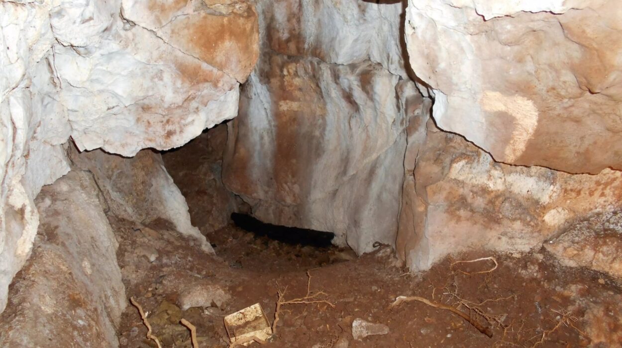
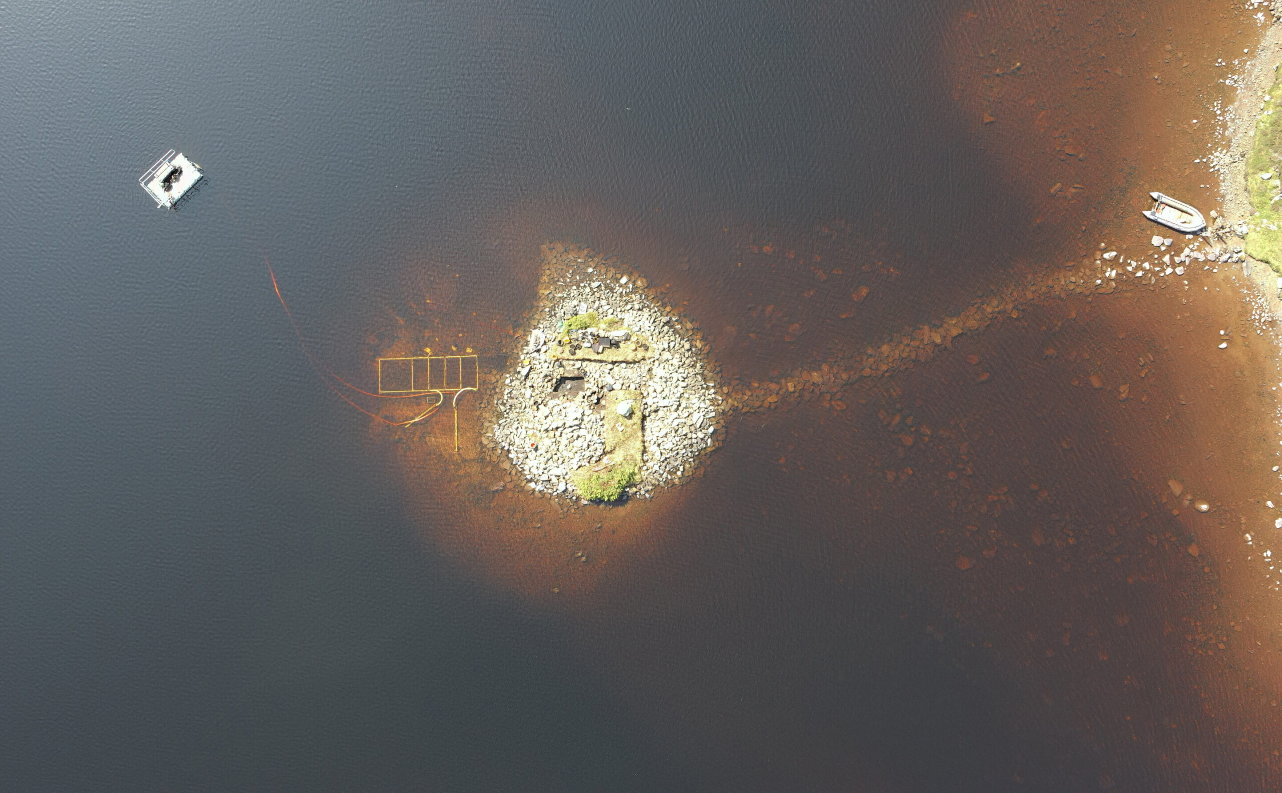
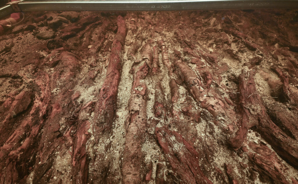
At first glance, the island in Loch Bhorgastail looks like a simple stone formation rising from the water. But beneath its surface lies something far more complex: a carefully engineered ancient structure built from wood, brushwood, and stone, preserved through thousands of years of environmental change.
Archaeologists from the University of Southampton, working alongside colleagues from the University of Reading, have been studying this so-called crannog—a type of artificial island found across Scotland’s lochs. Using a combination of excavation, coring, radiocarbon dating, and advanced digital surveying, the team has revealed that this particular site was not only human-made but also repeatedly modified over time.
Their findings show that the crannog began as a large circular wooden platform approximately 23 meters across, constructed more than 5,000 years ago. This places its origin firmly in the Neolithic period and makes it significantly older than iconic monuments such as Stonehenge.
A crannog with a long and layered history
What makes the Loch Bhorgastail crannog especially remarkable is its long sequence of construction phases. Rather than being a single-period structure, it appears to have been repeatedly rebuilt and adapted across thousands of years.
According to researchers, the earliest phase dates back to between 3800 and 3300 BC, when Neolithic communities first established the wooden platform and covered it with brushwood. This early construction already suggests a substantial investment of labor and organization, indicating that the communities involved were capable of coordinating large-scale building projects.
Around 2,000 years later, during the Middle Bronze Age, the site was expanded. Another layer of brushwood and stone was added, reinforcing and reshaping the island. This was not the end of its use. Approximately 1,000 years after that, during the Iron Age, yet another phase of activity took place, further modifying the structure and integrating it into the surrounding landscape.
A stone causeway—now submerged beneath the water—once connected the crannog directly to the shoreline. This feature suggests controlled access to the island, reinforcing the idea that it served an important and possibly restricted role in ancient community life.
Ancient pottery scattered across the loch floor
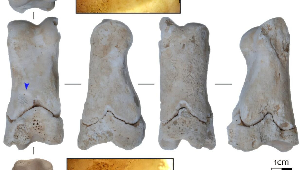
One of the most striking discoveries around the crannog is the presence of hundreds of fragments of Neolithic pottery scattered in the surrounding water. These include remains of jars and bowls, many of which still show signs of use.
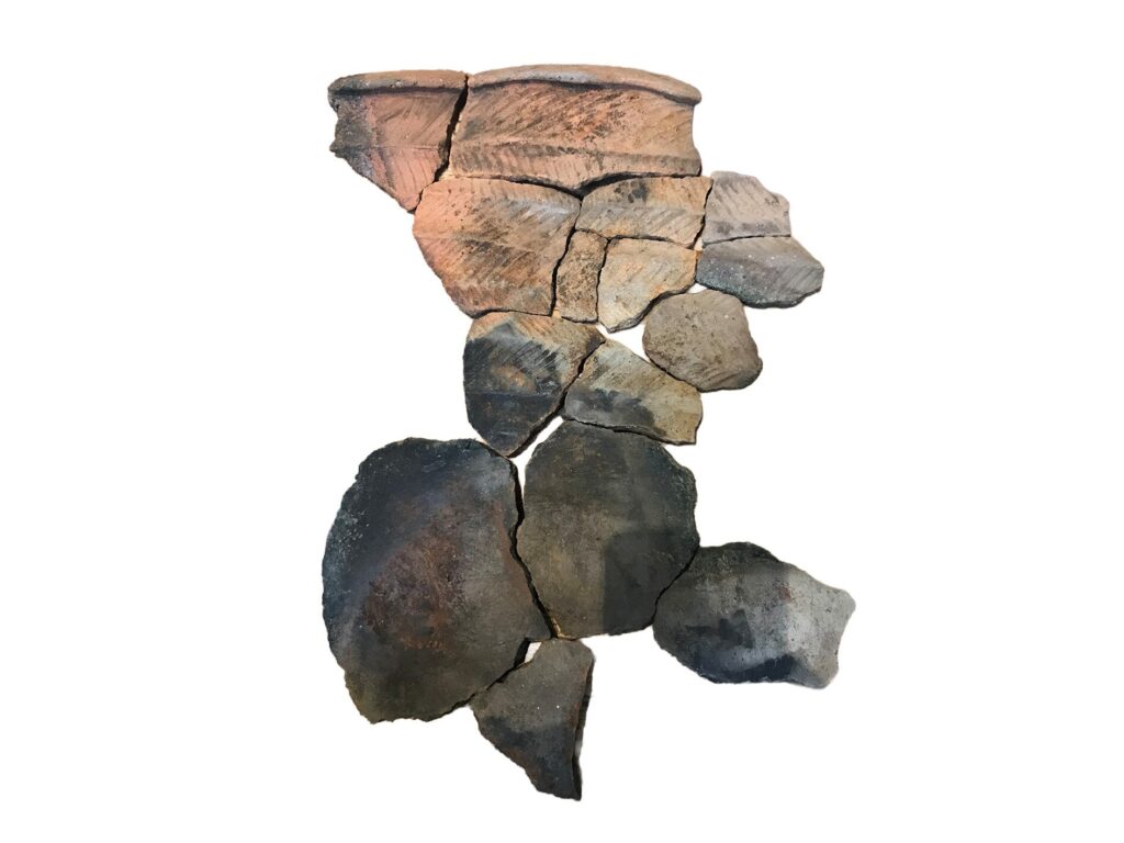
The distribution of pottery strongly suggests that the earliest phase of the site belongs to the Neolithic period, before later Bronze Age and Iron Age modifications. The artifacts point to repeated human presence and activity around the island’s perimeter, likely tied to daily life or organized communal events.
Some pottery pieces were found with traces of food residue still preserved, offering rare insight into how people interacted with the site. Alongside worked stone tools found nearby, these remains suggest that the crannog may have played a role in activities such as cooking or communal gatherings.
As University of Southampton archaeologist Dr. Stephanie Blankshein explains, crannogs across Scotland are often associated with long-term use and reuse. However, this site pushes that understanding further back in time, revealing that some were originally built in the Neolithic era, far earlier than previously assumed.
Seeing beneath shallow water in a new way
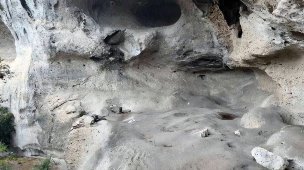
Uncovering the structure of the crannog required more than traditional archaeology. The team also developed and applied a new imaging method to study the site beneath shallow water conditions that are notoriously difficult to document.
In 2021, researchers used a technique known as stereophotogrammetry, combining underwater photography with advanced 3D reconstruction. Photogrammetry works by stitching together multiple two-dimensional images taken from different angles to create a detailed digital model of a site.
However, applying this method in shallow water presents significant challenges. Fine sediments, floating vegetation, and distorted light reflections often disrupt image quality, making accurate reconstruction difficult.
To overcome these issues, the researchers used two compact waterproof cameras mounted at a fixed distance on a rigid frame. This stereo setup allowed for overlapping imagery, improving depth perception and compensating for missing or distorted data. A diver carefully maneuvered the system through the water, maintaining centimeter-level positioning accuracy comparable to aerial drone surveys.
By combining stereophotogrammetry with drone technology and advanced post-processing, the team was able to produce a highly detailed and continuous model of the crannog, capturing both its submerged and exposed components as a single structure.
Professor Fraser Sturt of the Southampton Marine and Maritime Institute noted that shallow-water imaging has long frustrated archaeologists due to environmental interference. The new method helps address these limitations, offering a practical and cost-effective solution for future underwater surveys.
A breakthrough for coastal and underwater archaeology
This project marks the first publication from the University of Southampton’s Coastal & Inland Waters Heritage Science Facility. It demonstrates how emerging digital tools can transform the study of submerged archaeological sites, particularly in environments where visibility and access are limited.
The combination of underwater stereophotogrammetry and high-resolution digital modeling has provided researchers with a clearer understanding of how the Loch Bhorgastail crannog evolved over time. More importantly, it opens the door to investigating similar structures across Scotland and beyond, many of which remain unexplored or only partially documented.
Why this matters
The discovery at Loch Bhorgastail reshapes how archaeologists understand crannogs and the societies that built them. The evidence shows that these artificial islands were not simply medieval or Iron Age constructions but may have deep Neolithic origins stretching back more than 5,000 years.
This pushes the timeline of complex human engineering in Scotland further into the past than previously recognized. It also highlights the scale of organization, labor, and social coordination required to build and repeatedly modify such structures over millennia.
Beyond its historical significance, the project also demonstrates how modern imaging technology can reveal hidden archaeological landscapes that were previously inaccessible. By combining digital innovation with traditional excavation, researchers are now able to reconstruct ancient environments with unprecedented clarity.
Study Details
Stephanie Blankshein et al, At the Water’s Edge: Photogrammetry in Extreme Shallow-Water Environments, Advances in Archaeological Practice (2026). DOI: 10.1017/aap.2025.10145