A sophisticated new AI-driven framework has identified eight major U.S. coastal cities, including New York and New Orleans, as being at critical risk for severe flood damage. The study, published in Science Advances, reveals that the danger is driven not just by rising water, but by a volatile combination of sinking land, dense urban development, and inadequate natural drainage systems.
Imagine a storm surge pushing into a city where the water has nowhere to go because the ground is literally paved over with concrete. In many of America’s most iconic coastal hubs, this isn’t a hypothetical disaster scenario—it is a measurable, growing reality. While researchers have long mapped the trajectory of rising seas, a new study led by Hemal Dey and Wanyun Shao at the University of Alabama suggests that our traditional understanding of flood risk has been missing a vital piece of the puzzle. By shifting the focus from where the water will flow to why certain cities fail to withstand it, the research provides a stark look at the structural and social vulnerabilities of the U.S. coastline.
The challenge with historical assessments is that they often operate in a vacuum, focusing primarily on hydraulic models while overlooking the human and built environments. To bridge this gap, the researchers developed an integrated risk assessment framework. This model doesn’t just look at the height of a wave; it examines the complex interplay between environmental factors, existing infrastructure, and the demographic density of the people living in the line of fire. By feeding historical flood-damage data and 16 unique risk factors into three different types of artificial intelligence—Random Forest, Support Vector Machine, and Multilayer Perceptron—the team was able to pinpoint exactly which cities are most likely to face billions in property damage and significant loss of life.
The Eight Most Vulnerable Cities
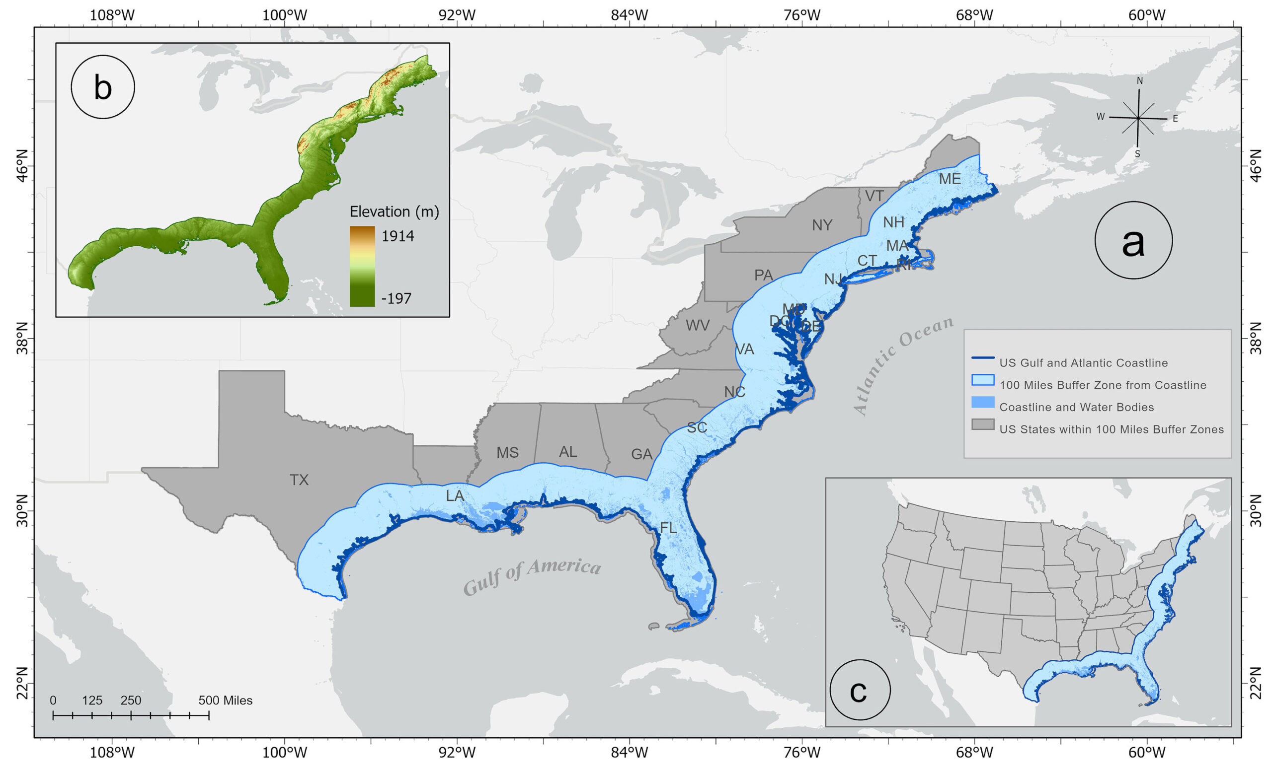
The AI analysis identified a “high-risk” group of eight cities spread across the U.S. Gulf and Atlantic coasts. These locations represent the most precarious intersections of geography and development in the country. The list includes New York, NY; Norfolk, VA; Charleston, SC; Jacksonville, FL; Miami, FL; Mobile, AL; New Orleans, LA; and Houston, TX. While all eight face significant threats, the study distinguishes between two types of danger: General Flood Damage (GFD) and the much more catastrophic Extreme Flood Damage (EFD).
The data shows that New York City and New Orleans stand as the two most vulnerable urban centers in the nation, though their paths to potential disaster are strikingly different. In New York, the primary driver is the sheer scale of the population exposed. The study estimates that 4.75 million people are at risk under a general flooding scenario, while 4.40 million remain in the crosshairs during extreme events. This vulnerability is exacerbated by the city’s “gray” infrastructure. Massive urban sprawl has replaced natural, absorbent soil with impervious surfaces like concrete and asphalt, preventing water from being soaked into the ground. Compounding this is land subsidence, a process where the land itself is sinking, effectively meeting the rising ocean halfway.
New Orleans presents a different, arguably more existential, crisis. The AI model found that nearly 99% of the population and infrastructure in New Orleans are at risk under both general and extreme scenarios. Because much of the city is situated below sea level, the most basic tool for flood management—gravity—is rendered useless. When water enters the city, it cannot drain away naturally; it must be mechanically moved, leaving the entire metropolitan area at the mercy of its levee and pump systems.
Decoding the Drivers of Disaster
The study’s true value lies in its ability to rank the factors that turn a heavy rain or a storm surge into a financial and humanitarian catastrophe. For general flooding events, the AI identified elevation as the most significant predictor of risk. This confirms the intuitive logic that low-lying areas will naturally collect the most water. However, the variables shift when the model looks at extreme damage. For the most severe events, the leading factor is drainage density, which refers to the number of streams and rivers packed into a specific area. When these natural channels are overwhelmed or restricted by urban growth, the resulting damage scales exponentially.
The third most critical factor across all scenarios is population density. The researchers noted that regardless of how severe a flood actually is, the impact is fundamentally tied to how many people are concentrated in the affected zone. By packing millions of residents into high-risk coastal strips, cities have inadvertently created a “force multiplier” for disaster impact. The researchers concluded that the greatest risks are consistently found in low-lying, densely developed urban areas that possess high drainage density.
Why This Matters
This AI-driven framework marks a significant shift in how policy-makers can approach climate adaptation. By pinpointing the specific “underlying factors” of risk—whether it is sinking land in New York or the lack of gravity-fed drainage in New Orleans—local governments can move beyond general warnings and toward targeted infrastructure projects.
The study provides a scalable tool that can be applied to other flood-prone regions globally, offering actionable insights for managing the billions of dollars in property and infrastructure currently under threat. As hurricane activity intensifies and sea levels continue to climb, understanding the “why” behind urban vulnerability is the only way to build a more resilient coastline. For the millions of Americans living in these eight cities, the findings aren’t just data points; they are a roadmap for survival in an increasingly watery future.
Study Details
Hemal Dey et al, A tale of two coasts: Unveiling US Gulf and Atlantic coastal cities at high flood risk, Science Advances (2026). DOI: 10.1126/sciadv.aec2079