For centuries, the search for lost civilizations was an endeavor of explorers hacking through jungles, desert wanderers following faint trails, or divers plunging into the depths of seas. The great discoveries of the past—Machu Picchu nestled in the Andes, Troy beneath layers of earth, Petra carved into desert cliffs—came at the cost of time, danger, and often sheer luck. Yet today, a new method is reshaping archaeology: the ability to peer down from the heavens.
Satellite archaeology is not the work of Indiana Jones-style adventurers but of scientists and engineers who harness the power of technology orbiting high above Earth. With satellites equipped with multispectral cameras, radar systems, and thermal sensors, researchers can uncover traces of human activity invisible to the naked eye. Ancient roads buried beneath forests, forgotten cities swallowed by shifting sands, and long-vanished trade networks leave subtle signatures in the landscape—signatures that satellites can capture.
It is a revolution in how we see the past. Where once archaeologists had to dig blindly, now they can pinpoint potential sites with uncanny precision, guided by data that comes not from shovels but from space.
The Origins of a Cosmic Perspective
The idea of viewing Earth’s ancient history from above is not entirely new. Early aerial photography, pioneered during World War I, offered the first tantalizing glimpse of what altitude could reveal. Archaeologists flying in rickety planes over fields noticed strange patterns—lines, circles, and shapes—that turned out to be buried walls, roads, or tombs.
But satellites took this perspective to an entirely new level. When the first Earth-observing satellites launched in the mid-20th century, their primary missions were for military reconnaissance and meteorology. Yet scientists soon realized that these tools could serve another purpose: mapping the human past.
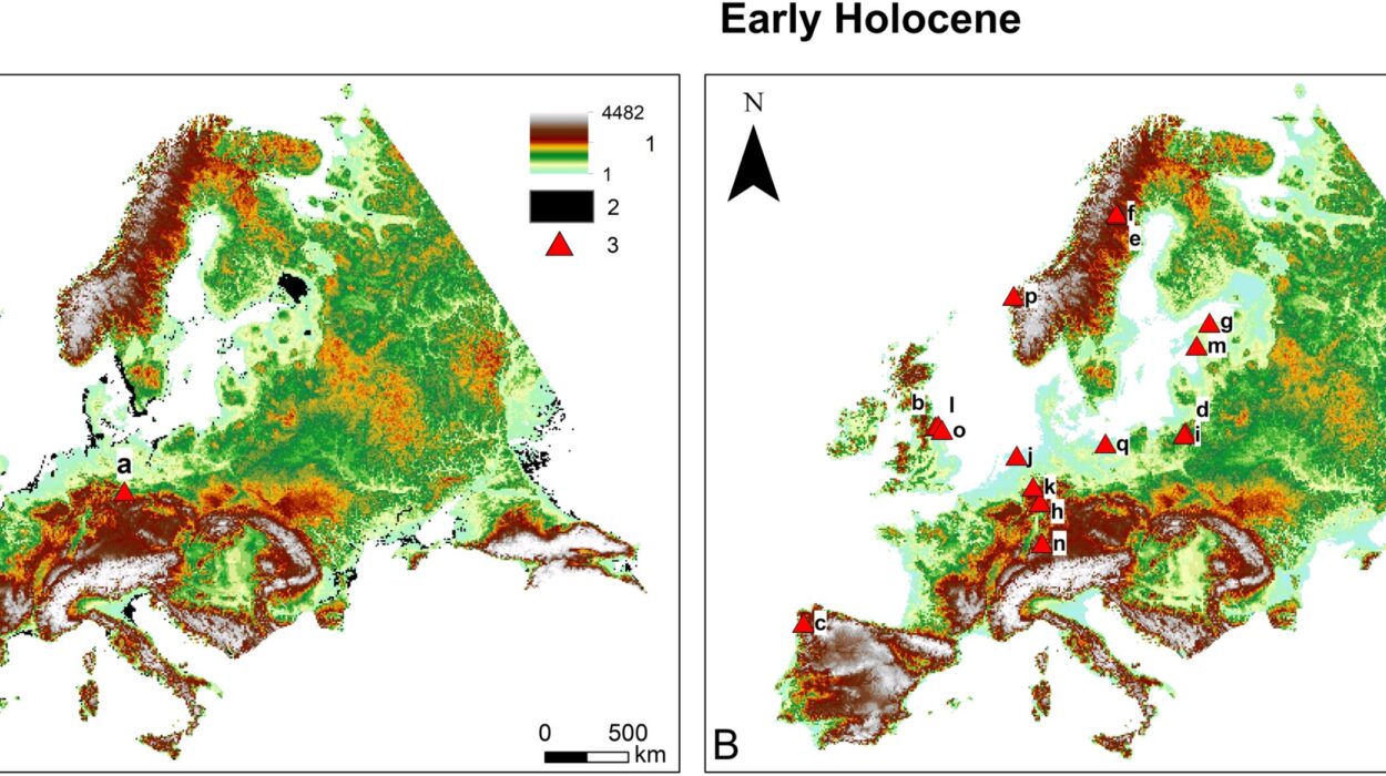
One of the earliest breakthroughs came from the Landsat program, beginning in 1972. Landsat’s sensors captured images in multiple wavelengths of light, including those invisible to the human eye. This allowed archaeologists to detect variations in vegetation, soil moisture, and ground temperature—all subtle indicators of buried structures. Suddenly, the invisible past began to glow on the satellite screens.
How Satellites See the Past
To understand the magic of satellite archaeology, we must look at how satellites “see.” Unlike human vision, limited to the narrow band of visible light, satellites can capture data across the electromagnetic spectrum. This includes infrared, radar, and even thermal imaging.
- Multispectral and Hyperspectral Imaging: Different materials reflect light differently. Stone walls, clay bricks, and compacted soil leave distinct spectral signatures. Buried ruins may alter vegetation growth above them—plants may appear stunted where walls block roots or unusually lush where ancient irrigation systems lie. Satellites detect these differences, revealing patterns invisible to ground observers.
- Radar (Synthetic Aperture Radar, SAR): Radar waves penetrate clouds, vegetation, and even sand. SAR can reveal structures beneath desert dunes or tropical canopies, making it invaluable for exploring areas otherwise inaccessible.
- Thermal Imaging: Variations in ground temperature can indicate underlying features. For example, buried stone absorbs and releases heat differently from surrounding soil, creating faint but detectable thermal patterns.
By combining these technologies, archaeologists can generate detailed maps of ancient landscapes, reconstructing roads, canals, and even entire cities.
Lost Cities Reborn from Orbit
The power of satellite archaeology lies not just in its technology but in its stories. Time and again, it has brought forgotten civilizations back into the light.
Egypt’s Hidden Treasures
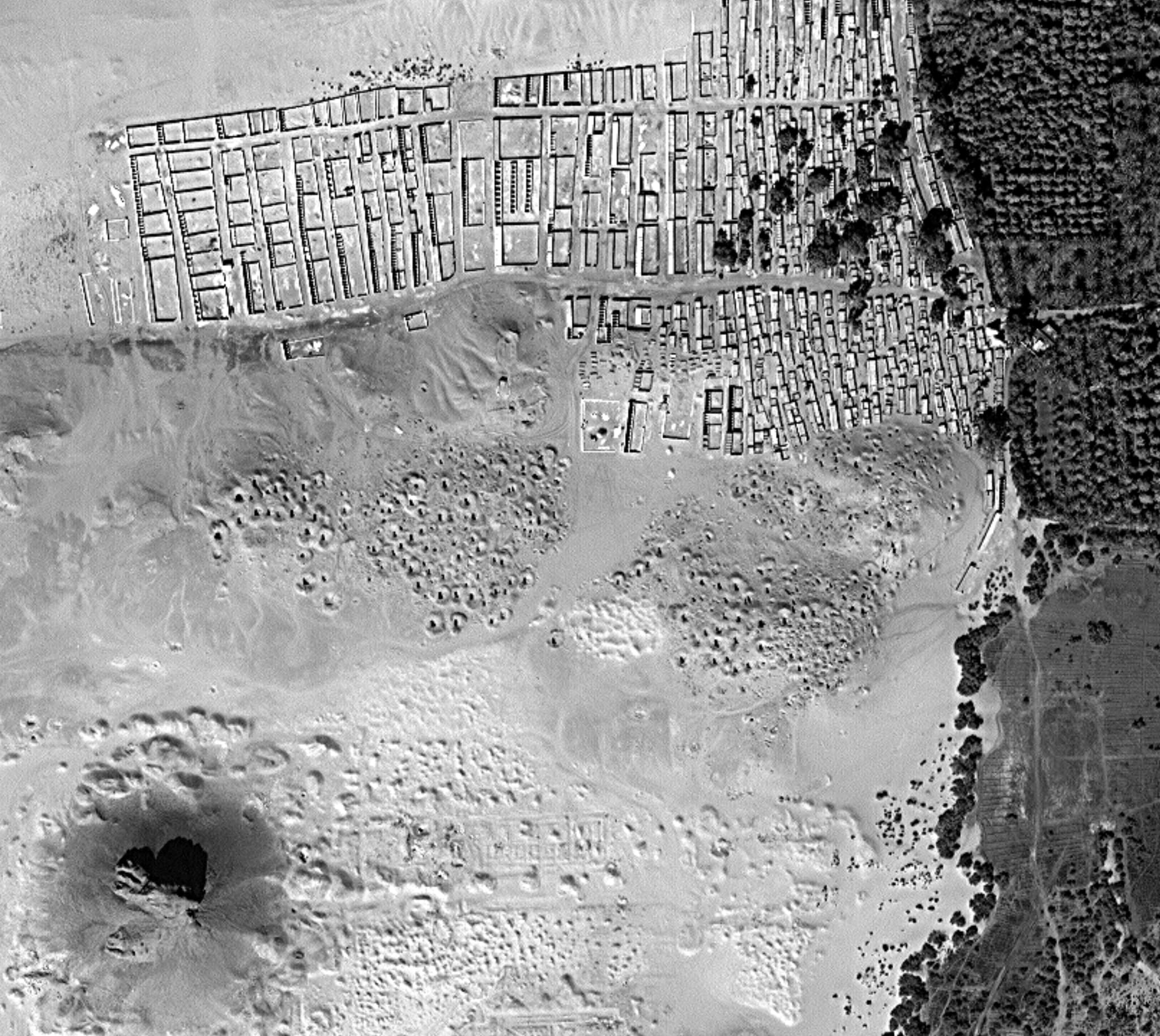
Egypt has long been a magnet for archaeological discovery, but even in this well-studied land, satellites have revealed secrets. In 2011, researcher Sarah Parcak used satellite imagery to identify more than 3,000 potential ancient settlements, 1,000 tombs, and 17 pyramids hidden beneath the sands. These structures, invisible to ground-level surveys, emerged as faint rectangular outlines or shifts in soil composition detectable from orbit.
Parcak’s work earned her the nickname “Space Archaeologist” and demonstrated that even the most explored regions still hold mysteries waiting in the shadows.
The Amazon’s Forgotten Civilizations
For decades, the Amazon rainforest was believed to be largely untouched by ancient urbanization. Yet satellite images told a different story. In recent years, researchers have identified geometric earthworks—known as geoglyphs—sprawling across parts of the forest. These patterns suggest large, organized societies once thrived in the region, building roads, ditches, and ceremonial structures long before European contact.
The discovery rewrote the history of the Amazon, revealing it as a cradle of complex societies, not an untouched wilderness.
The Desert Roads of the Middle East
The arid landscapes of the Middle East are littered with traces of ancient civilizations, but many remain hidden beneath shifting sands. Satellite imagery has revealed extensive networks of roads, caravanserais, and settlements once part of vast trade systems connecting Mesopotamia, Arabia, and beyond. These discoveries help archaeologists reconstruct the economic lifelines of ancient empires.
The Maya World Rediscovered
The dense jungles of Central America once concealed much of the Maya civilization. Satellite data combined with LiDAR (light detection and ranging) has transformed this picture. By stripping away vegetation digitally, researchers uncovered entire city complexes, including roads, pyramids, and fortifications, revealing that Maya urbanization was far more extensive than previously imagined.
Advantages Over Traditional Methods
Traditional archaeology, though invaluable, has limitations. Excavation is slow, expensive, and destructive—once a site is dug up, it can never be restored to its original state. Surveys on foot or by vehicle can cover only limited ground.
Satellite archaeology, in contrast, provides a bird’s-eye view of vast regions. A single satellite image can reveal patterns across hundreds of kilometers, offering context that ground surveys might miss. It is also non-invasive: sites can be studied without disturbing them, preserving them for future generations.
Perhaps most importantly, satellites allow archaeologists to work in areas that are politically unstable, environmentally dangerous, or simply inaccessible. From war-torn regions to inhospitable deserts, satellites offer safe and efficient exploration.
Challenges and Limitations
Despite its promise, satellite archaeology is not without challenges.
- Resolution Limits: Even the most advanced satellites may struggle to capture fine details. Small structures or subtle features can escape detection.
- False Positives: Natural formations may mimic archaeological patterns, leading to misinterpretations. Ground verification is still necessary to confirm findings.
- Cost and Access: High-resolution satellite imagery can be expensive, and access is often restricted. Not all researchers or institutions have the resources to obtain the best data.
- Environmental Changes: Modern development, agriculture, and climate change can obscure or destroy archaeological signatures, complicating interpretation.
Satellite archaeology is a tool, not a replacement for fieldwork. It guides archaeologists toward promising sites, but the spade and brush remain essential for uncovering details and context.
The Human Element in a Technological Age
One might imagine that with satellites scanning every corner of Earth, archaeology would become a purely technological endeavor. Yet this is far from the truth. Technology provides the data, but it is human curiosity, creativity, and interpretation that breathe life into discoveries.
When an archaeologist looks at a faint rectangular shape on a satellite image, they do not see pixels—they see the ghost of a marketplace, the outline of a temple, or the memory of a road once bustling with travelers. It is imagination combined with evidence that transforms satellite data into human history.
The Role of Citizen Science
In recent years, satellite archaeology has expanded beyond professional researchers. Platforms like GlobalXplorer, launched by Sarah Parcak, allow ordinary people around the world to examine satellite images and identify potential sites. With thousands of eyes scanning countless images, the pace of discovery accelerates.
This democratization of archaeology turns exploration into a shared human endeavor. A teacher in Canada, a student in India, or a retiree in Brazil can all contribute to uncovering humanity’s lost heritage.
Preserving Heritage in the Modern Age
Satellite archaeology is not only about discovery—it is also about protection. Many archaeological sites are under threat from looting, urban expansion, and conflict. Satellites can monitor these areas in real time, documenting damage and helping authorities intervene.
During the Syrian civil war, for example, satellite imagery was used to track the destruction of ancient sites like Palmyra, providing evidence for cultural preservation efforts. In this way, satellites become guardians of heritage, bearing witness to humanity’s treasures even in times of turmoil.
Looking Beyond Earth: Astrobiology and Cosmic Archaeology
The principles of satellite archaeology extend even beyond our planet. As scientists search for traces of life on Mars or the Moon, they employ similar methods—using orbiters equipped with cameras, radar, and spectrometers to scan for signs of ancient rivers, settlements, or even microbial life.
In a sense, satellite archaeology prepares us for the ultimate exploration: not just of Earth’s past but of life’s potential beyond Earth. The tools that uncover lost cities today may one day reveal extraterrestrial civilizations—or at least the environments where life once thrived.
The Poetry of Seeing the Past from Space
There is something profoundly moving about the idea that we can stand on Earth, gaze up at the night sky, and know that from those heights, the story of our ancestors is visible. Satellites transform landscapes into palimpsests, where the layers of history—ancient fields, forgotten roads, vanished cities—emerge like whispers of time.
It is as though Earth itself remembers, and satellites give us the key to read its memory. The deserts are not empty, the jungles are not silent, the plains are not barren—they are filled with the echoes of civilizations, waiting patiently to be rediscovered.
The Future of Satellite Archaeology
The field is still young, and its future holds astonishing possibilities. Advances in artificial intelligence will allow machines to scan satellite data automatically, detecting archaeological features with ever-increasing accuracy. Higher-resolution satellites, hyperspectral imaging, and integration with drone-based surveys will push the boundaries of discovery even further.
We may soon map entire civilizations that have been erased from history books, reconstruct ancient trade routes across continents, and uncover sites that redefine our understanding of human evolution.
In this future, archaeologists may spend less time searching and more time interpreting, weaving the threads of data into the grand tapestry of human history.
Conclusion: Humanity’s Eternal Quest
Satellite archaeology is more than a scientific method—it is a continuation of humanity’s eternal quest to know itself. From the first explorers who carved maps on parchment to the satellites orbiting hundreds of kilometers above, the drive remains the same: to understand where we came from, how we lived, and what we left behind.
The sky, once a distant canopy of stars, has become our greatest ally in unearthing the ground beneath our feet. Lost cities, once thought forever buried, now rise again in digital form, their outlines glowing against the landscape as if waiting for us to remember.
Through satellite archaeology, the past is not lost—it is waiting. And as we look to the skies, we find not only the future of exploration but the timeless truth that our history is written on the Earth itself, etched in patterns visible from the heavens.