In the realm of geophysics, certain patterns are expected—tectonic plates grind, faults slip, magma surges. But in September 2023, the Earth sent out a signal that baffled scientists across the globe: a rhythmic seismic pulse, repeating every 90 seconds, like the tick of an unearthly metronome. These signals echoed continuously for nine days, stopped, and then returned a month later. Unlike anything geologists had recorded before, this planetary heartbeat set off a scramble for answers. Seismologists were sure it wasn’t machinery, wasn’t human. But if it came from nature—what force could possibly shake the entire Earth with such clockwork precision?
Nearly a year later, that mystery has found its solution, hidden in one of the most remote and under-observed landscapes on the planet: a secluded fjord in East Greenland. And the answer involves a pair of colossal tsunamis, glacier-triggered landslides, and waves that, incredibly, bounced back and forth for days—unseen by any ship, unheard by any weather station, yet powerful enough to rock the crust of the planet.
The Silent Violence of Greenland’s Melting Frontier
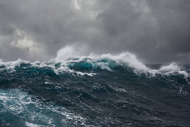
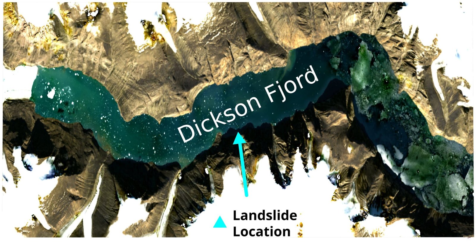
This wasn’t a Hollywood-style tsunami roaring across open oceans. These were fjord-bound mega-waves—contained and strangely persistent. The story begins in East Greenland, in a still-unnamed fjord locked deep in Arctic solitude. Warming air and ocean currents have quietly been transforming this frozen realm, weakening glacier faces that haven’t moved in millennia. In this case, the weakening reached a catastrophic threshold.
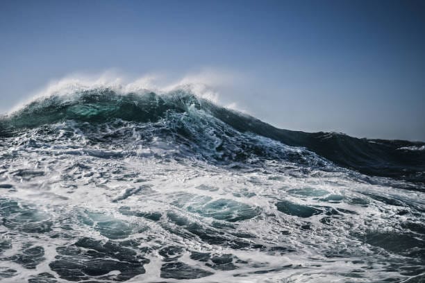
According to two new scientific studies, twin landslides—massive collapses of mountain slopes destabilized by glacial retreat—crashed into the waters of this hidden fjord, likely within hours of each other. The displaced water surged upwards and outwards, forming tsunami-like waves tens of meters high. But unlike oceanic tsunamis that disperse across thousands of kilometers, these waves had nowhere to go. They rebounded between the walls of the fjord, trapped in a watery cage.
These weren’t ordinary echoes of water. What emerged were seiches—standing waves that sloshed rhythmically, like water in a giant tilted bathtub. They persisted for days, setting up a resonant oscillation that reached far beyond the fjord’s confines. The waves were so large, and their mass shifted with such force, that they nudged the crust of the Earth itself, producing rhythmic seismic tremors recorded thousands of kilometers away.
Yet nobody saw them. No camera captured the wave. Even a Danish military vessel that arrived three days into the first event failed to detect the seiches visibly. For nearly a year, the world had seismic fingerprints of an event whose face remained veiled in Arctic mist.
A New Eye in the Sky
The game-changing breakthrough came not from the ground, but from the skies—specifically, a satellite launched in December 2022 called SWOT: Surface Water and Ocean Topography. Jointly developed by NASA and CNES (the French space agency), SWOT represents a technological leap in Earth observation.
Unlike conventional altimetry satellites, which sample only a thin vertical slice directly beneath their orbit and update infrequently, SWOT’s Ka-band Radar Interferometer (KaRIn) looks sideways—left and right—across a swath 50 kilometers wide. Mounted on a boom that spans 10 meters, its dual antennas create an interferometric baseline, allowing triangulation of radar pulses to resolve water height with a jaw-dropping resolution of 2.5 meters. For the first time, satellites could “see” the shape of water in motion across large areas.
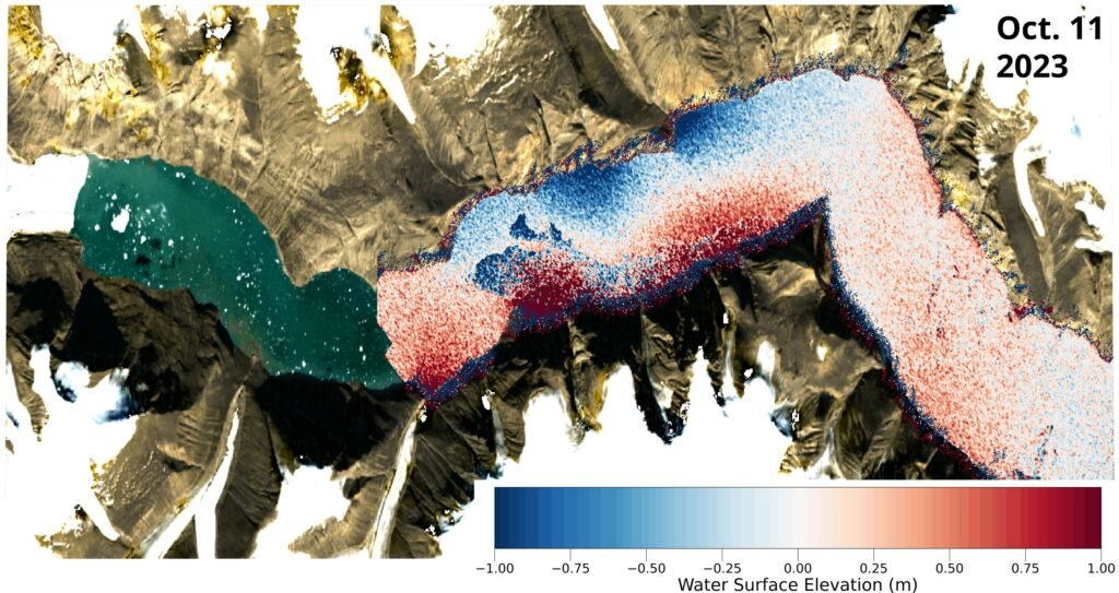
Oxford University researchers, led by DPhil student Thomas Monahan, used SWOT data to create elevation maps of the East Greenland fjord at multiple time points following the twin tsunami events. The maps revealed cross-channel slopes in water height—some showing water levels two meters higher on one side than the other, and then reversing. This pattern is the signature of a seiche: the fjord-sized water wave rolling back and forth, like a sloshing bowl.
This was more than just a confirmation. It was the first-ever satellite observation of a seiche of this nature, captured in the act. A wave, invisible to ships and buoys, had been laid bare by radar eyes orbiting hundreds of kilometers above.
Proving the Pulse
Of course, spotting the wave pattern wasn’t enough. The team needed to prove that the wave was not only real, but responsible for the bizarre seismic signals detected worldwide. To do this, they linked the water movement revealed by SWOT to subtle crustal shifts recorded by seismic stations across the globe.
Water mass is heavy—very heavy. When it moves coherently, as in a tsunami or seiche, it applies changing pressure on the Earth’s crust, causing it to flex microscopically. These “gravity waves” of mass redistribution can be picked up by sensitive instruments as far as thousands of kilometers away. By modeling how the mass of water in the fjord was shifting with each slosh of the seiche, the researchers showed it matched the frequency, timing, and strength of the rhythmic seismic pulses recorded in 2023.
To eliminate other possibilities, they also modeled local wind conditions and tidal forces during the period. Neither winds nor tides could explain the scale or rhythm of the phenomenon. The wave had no other possible culprit. It was a standing wave born from climate-induced chaos.
As Professor Thomas Adcock, co-author of the study, noted, “This study is an example of how the next generation of satellite data can resolve phenomena that have remained mysteries in the past.”
What This Means for Earth and Climate Science
This discovery opens the floodgates—figuratively and literally—for a new era in ocean and climate science. Seiches are not new; they’ve been observed in lakes, harbors, and even swimming pools during earthquakes. But the idea that massive, fjord-scale seiches can persist for days and send seismic signals across the planet was, until now, theoretical at best.
This event proves that as glaciers melt and permafrost weakens, Earth’s changing climate can trigger extreme geophysical phenomena in remote regions that ripple through the whole planet. The landslides themselves were likely caused by the destabilization of glacial flanks—rock and ice held in place for centuries, now collapsing into the sea due to warming temperatures. The tsunamis were an echo of that collapse. The seiches were an echo of the echo. And the seismic signals were an echo of the echo’s echo, ricocheting around the world.
What’s most remarkable is that we wouldn’t have known any of this without SWOT.
In Arctic regions, where physical sensors are sparse, satellites may be the only tool we have to monitor these fast-emerging threats. SWOT’s success in detecting the Greenland event points to a broader future where satellite-based hydrology becomes essential—not just for academic curiosity, but for hazard detection, tsunami early warning, and climate resilience planning.
Earth’s Rhythms, Rediscovered
This study is also a powerful demonstration of scientific detective work at its finest. A signal was detected—a 90-second heartbeat of the planet. At first, no one could explain it. But piece by piece, researchers built a forensic case that spanned seismology, oceanography, glaciology, radar physics, and orbital engineering.
In doing so, they showed that Earth’s most mysterious behaviors are often the ones least visible. Remote fjords, once thought to be passive victims of climate change, are revealed as active players. Their shifting ice and land can unleash waves of destruction—quietly, persistently, even invisibly.
The Greenland seiche event may go down as a historic turning point: not only for what it taught us about Arctic tsunamis, but for what it showed about how we observe our planet. Just as Einstein changed our view of spacetime, SWOT and its radar interferometer are changing our view of water-in-motion—tracking not just coastlines and lakes, but the secret dances of remote oceans, hidden from human eyes for all of history.
As Thomas Monahan put it: “Climate change is giving rise to new, unseen extremes… This study shows how we can leverage the next generation of satellite Earth observation technologies to study these processes.”
A Warning—and a Promise
The Greenland seiche isn’t just a scientific marvel. It’s a warning bell. As the planet warms, landscapes we’ve always considered stable—glaciers, permafrost, fjords—are entering new, unstable regimes. That instability can produce not only local devastation, but planetary signals. The Earth is changing in ways we’ve never witnessed before, and often in places we don’t expect.
Yet this is also a story of promise. The technology exists to observe, analyze, and understand these changes. With tools like SWOT, and the ingenuity of researchers combining physics with machine learning and global data synthesis, we can start to chart the unknown.
There will be more signals. Some already ripple through the oceans, waiting to be deciphered. Others have yet to be born. But thanks to satellites, science, and a world connected by data, we now have the eyes to see them—and perhaps, the wisdom to act.
Reference: Observations of the seiche that shook the world, Nature Communications (2025). DOI: 10.1038/s41467-025-59851-7. www.nature.com/articles/s41467-025-59851-7