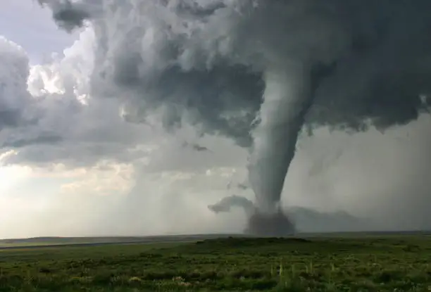
On the Great Plains, the sky has a way of keeping secrets until the very last moment. A calm afternoon can turn violent in minutes, and for decades, tornado warnings have followed that same rhythm. Forecasters wait, watch, and warn only when danger is already unfolding. Usually, that gives people about 15 minutes to react.
Now, researchers at the University of Kansas are asking a daring question: what if the atmosphere tells its story earlier, and we learn how to listen?
Their new study, published in the peer-reviewed journal Weather and Forecasting, shows that an experimental system called the Warn-on-Forecast System, or WoFS, could allow forecasters to issue tornado warnings far earlier than ever before, in some cases nearly an hour before a tornado forms. In places like the Great Plains and the tornado-prone Southeast, that difference is not just academic. It could mean lives saved, injuries avoided, and communities better prepared.
The Limits of Seeing Danger Only When It Appears
Right now, tornado warnings rely on what meteorologists call a warn-on-detection approach. According to David Rahn, a professor of geography and atmospheric studies at KU and a co-author of the study, this means warnings are issued only when a tornado is already happening or about to happen.
Forecasters watch radar for signs of rotation. They listen for storm spotters reporting funnels touching down. When those signals appear, alerts go out.
But the atmosphere gives hints long before that moment. Days ahead of time, meteorologists may know severe weather is likely. As the event draws closer, forecasts narrow into watches. Yet warnings are withheld until danger is imminent.
That gap between knowing severe weather is possible and knowing a tornado is likely has always been the hardest space to fill. WoFS is designed to live inside that gap.
Teaching Computers to Imagine the Storm Before It Exists
Unlike traditional warning systems, WoFS does not wait for a tornado to appear on radar. Instead, it tries to forecast the conditions that make tornadoes possible.
The system does this by synthesizing observational data in real time and running high-resolution simulations of the atmosphere. These simulations are detailed enough to capture the small-scale features inside storms, while also estimating uncertainty, something traditional models struggle to do at such fine detail.
Rahn describes the goal simply: increase lead times well beyond the typical 15 minutes. In some scenarios, the system shows potential to extend that window to nearly 60 minutes.
That extra time could change everything. But first, the researchers needed to answer a crucial question: can WoFS actually tell the difference between a storm that will produce a tornado and one that will not?
Inside 41 Dangerous Storms
To test the system, the research team analyzed 41 supercells across the Great Plains. Each of these storms resulted in either tornadoes rated at least EF1 on the Fujita scale or dangerous but non-tornadic events classified as significant hail.
Supercells are powerful storms capable of producing tornadoes, but not all of them do. Understanding why one supercell spins up a tornado while another simply hurls giant hailstones has long been a challenge in meteorology.
The researchers weren’t just hunting for extreme values. Instead, they looked for patterns in the environment surrounding the storms.
What they found shifted the way tornado potential can be recognized.
Why Size and Shape Matter More Than Peaks
One of the study’s major findings is that the size and extent of favorable environmental pockets matter more than single maximum values.
If forecasters focus only on the strongest individual readings, such as a single peak measurement, tornadic and non-tornadic storms can look deceptively similar. But when researchers examined larger, well-defined areas of enhanced conditions, clear differences emerged.
One of the most important signals was storm-relative helicity, a measure of how the wind twists and turns near the ground in relation to a storm.
Rahn explains it with an image that feels almost playful. He compares storm-relative helicity to a spiraling football. As that spiraling motion enters a storm’s updraft, it tilts upright, turning horizontal spin into vertical rotation. That vertical rotation is the energy tornadoes draw from.
The stronger and more extensive that corkscrew motion is, the more likely a tornado becomes.
WoFS excels at identifying these broad, organized areas of helicity rather than just isolated spikes. That makes it particularly powerful at signaling which storms are developing the right internal structure for tornado genesis.
The Subtle Ingredients That Tip the Balance
Storm-relative helicity wasn’t the only clue.
The researchers also found that tornado-producing storms tended to share other environmental features. These included lower cloud bases, stronger low-level wind shear, and small pockets of enhanced rotation near the storm’s inflow region, the area where warm, moist air feeds into the storm.
Each of these factors on its own might not guarantee a tornado. Together, they form a recipe that dramatically increases the odds.
Because WoFS models these exact parameters at very fine spatial scales, it can detect these warning signs earlier than radar-based systems. In some cases, the system identified signals of tornado formation up to an hour before a tornado actually developed.
That kind of foresight represents a fundamental shift in how warnings could be issued.
From Experimental Code to Public Service
Right now, WoFS is still in the experimental phase. Its primary users are forecasters at the National Weather Service, but its reach is intentionally broader.
The system is cloud-based, accessible in real time, and designed to be freely available to meteorologists and the public. Rahn emphasizes that this openness is no accident. The National Weather Service operates as a public good, and its tools are meant to serve everyone, not generate profit.
That philosophy extends beyond technology into education and training.
The lead author of the study, Jerod Kaufman, completed this work as his master’s thesis at KU. Today, he works at the Wichita National Weather Service, using the same ideas he studied in the classroom to protect the public.
Rahn sees this as a powerful example of research moving directly into operations. Graduate-level science doesn’t stay locked in journals. It becomes part of real-world forecasting, decision-making, and public safety.
The Quiet Power of Time
When people imagine tornado safety, they often think about storm shelters, sirens, and last-second dashes for cover. But Rahn points out that the true power of improved forecasting lies in something quieter: time.
An extra 45 minutes may not sound dramatic, but for emergency managers, it can be transformative. With longer lead times, county officials can position resources, coordinate hospitals, and prepare search-and-rescue teams before disaster strikes.
For families, that time can mean leaving a mobile home, securing a safer shelter, or simply avoiding panic.
For forecasters, it means shifting from reacting to disasters to anticipating them.
Why This Research Matters
The mission of the National Weather Service is to protect lives and property. This research shows a path toward fulfilling that mission more effectively than ever before.
By moving beyond detection and into prediction, WoFS challenges the long-standing limits of tornado warnings. It suggests that the atmosphere’s whispers can be heard well before it roars, if we know where to listen.
An hour of lead time instead of 15 minutes is not just an improvement. It’s a different world of possibility. In tornado country, where minutes can define outcomes, that difference could reshape how communities prepare, respond, and survive.
The sky will always be powerful. But with tools like Warn-on-Forecast, humanity is learning how to read its intentions sooner, and act before the story turns tragic.
Study Details
Jerod W. Kaufman et al, A Comparative Analysis of Near-Storm Environments for Tornadic and Nontornadic Significant-Hail Supercells using the Warn-on-Forecast System (WoFS), Weather and Forecasting (2025). DOI: 10.1175/waf-d-25-0016.1