On a humid summer afternoon, a thunderstorm brews hundreds of kilometers away. To the naked eye, it’s invisible — just another hazy horizon. Yet somewhere, silently spinning on a distant hill or mounted on a tall tower, a weather radar has already spotted it. Invisible pulses of radio energy have swept through the sky, bounced off the raindrops in the storm, and returned home carrying news: the storm is growing, moving fast, and may soon arrive at your doorstep. This unseen process happens every moment of every day, not just over your city, but across oceans, deserts, and mountains, thanks to the marriage of radar and satellite technology.
It’s easy to take it for granted — the little rain icons on your weather app, the warning that a storm will hit at 3:45 p.m., the radar animations that show clouds marching across continents. But behind these conveniences lies one of the most sophisticated and quietly heroic scientific achievements of the modern age. To understand how weather radar works anywhere in the world is to glimpse the artistry and precision of a system that quite literally watches over us.
The Birth of a Technology That Could See the Invisible
Weather radar wasn’t born in a meteorologist’s laboratory. Its roots go back to the grim urgency of the Second World War, when scientists and engineers sought ways to detect enemy aircraft long before they appeared over the horizon. They discovered that radio waves, when beamed into the sky, could bounce off metal objects and return to the transmitter. The time delay between sending and receiving the pulse could reveal the object’s distance, and the strength of the return signal could suggest its size.
But there was a curious twist: sometimes, the radar screens lit up even when no airplanes were present. These “false echoes” puzzled the military — until they realized that the culprit was rain. Raindrops, hailstones, and snowflakes were also excellent reflectors of radio waves. What was a nuisance in wartime became an invaluable discovery in peacetime. If radar could see rain, it could be used to track storms.
After the war, the technology was adapted for civilian use, evolving into the specialized weather radar systems we know today. These systems could peer through clouds and darkness, spotting storms far beyond human sight. They became the backbone of modern weather forecasting.
How a Radar Sees Raindrops
The basic principle behind weather radar is deceptively simple, yet it involves a delicate dance of physics. A radar system sends out bursts of microwave energy into the atmosphere. These microwaves travel at the speed of light, racing outward until they strike something — a raindrop, a snowflake, a hailstone, or even a swarm of insects. When the wave hits such an object, part of its energy is scattered in all directions, and a small portion bounces straight back toward the radar dish.
The radar’s receiver picks up these returning echoes and measures two critical things: how long it took for the echo to return and how strong it is. The travel time tells the system how far away the precipitation is. The strength of the echo — known as reflectivity — reveals something about the size and concentration of the raindrops. Large hailstones send back much stronger signals than tiny droplets of drizzle.
Modern weather radar systems go further. By using the Doppler effect — the same principle that makes a passing ambulance’s siren change pitch — they can detect the motion of raindrops. If precipitation is moving toward the radar, the frequency of the returned signal is slightly higher; if it’s moving away, it’s slightly lower. This allows meteorologists not only to see where it’s raining, but also to measure the wind patterns inside storms, spotting dangerous rotation that might lead to tornadoes.
From Local Towers to Global Networks
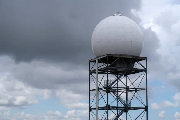
In the early days, weather radars were local tools. A single radar might cover a radius of a few hundred kilometers. That meant they were powerful for regional forecasts but useless for seeing what was happening on the other side of the country, let alone across the ocean.
The revolution came when these local radars were linked into networks. In the United States, for example, the NEXRAD system connects more than 150 Doppler radars into a nationwide web. Europe, Japan, Australia, and other regions developed their own networks, often sharing data across borders. The result was a vast radar mosaic — a picture of precipitation stretching across entire continents.
But even with all this coverage, there were still huge gaps — over the oceans, in remote deserts, atop high mountains. That’s where satellites stepped in.
The Satellite’s Watchful Eye
While radars see by sending out their own pulses, satellites see by looking down from above. Meteorological satellites orbit the Earth constantly, scanning vast swaths of the atmosphere. Some sit in geostationary orbit, locked over one part of the planet and taking snapshots every few minutes. Others circle the globe in polar orbits, covering every inch of Earth’s surface as the planet spins beneath them.
Satellites can see the swirling tops of clouds, the growth of storm systems, and even the moisture content of the atmosphere. While they can’t measure precipitation on the ground as directly as radar can, they provide an essential global view — especially over places where radar coverage is impossible.
The real magic happens when satellite and radar data are combined. Satellites can spot a storm far out at sea and track its movement toward land. As it approaches the radar coverage zone, ground-based radars can begin to map its internal structure, measuring rainfall intensity and wind speeds. Together, they create a seamless picture of weather anywhere in the world.
The Global Tapestry of Weather Surveillance
Today, the network of weather radars and satellites forms a planetary tapestry of observation. In some parts of the world, such as North America, Europe, and East Asia, radar coverage is dense and overlapping, offering minute-by-minute updates on storms. In other regions, particularly across parts of Africa and South America, radar is sparse — but satellites fill the gap, ensuring no part of the globe is truly blind.
International cooperation is key. Weather knows no borders, and neither can the systems that track it. Organizations like the World Meteorological Organization coordinate data sharing between nations, creating a continuous flow of information. A storm forming over the Indian Ocean may be detected by a satellite operated by one country, tracked by radar in another, and have its data fed into a forecast model used by yet another.
The Human Element: Reading the Signals
For all the technology’s sophistication, weather radar is not a self-driving system. Behind the glowing screens are human meteorologists, interpreting the data with a mix of science, training, and intuition. Radar echoes can be deceptive. Mountains can create false returns. Flocks of birds can mimic rain. Insects can appear as light showers. Skilled forecasters learn to read the subtle patterns — the way a squall line curves, the fingerprint of a hail core, the telltale hook echo of a tornado-producing storm.
When a forecaster sees dangerous conditions developing on radar, they can issue warnings that save lives. The minutes gained by such alerts can be the difference between safety and tragedy. It’s a reminder that, while the machines are marvels of engineering, their true power lies in the hands of those who use them.
Beyond Rain: New Frontiers for Radar
Weather radar is evolving. New systems use dual-polarization technology, sending out radio waves in both horizontal and vertical orientations. This allows them to distinguish between raindrops, snowflakes, and hailstones, and even to detect non-meteorological objects like smoke or volcanic ash. In some cases, radar has been used to monitor the migration of birds, track locust swarms, and study the patterns of bats emerging from caves at dusk.
Mobile radar units can be deployed to storm-prone areas, allowing scientists to study tornadoes and hurricanes up close. Airborne radars mounted on research aircraft can slice through storms from above, revealing structures invisible to ground-based systems. These advances push the boundaries of what we can see — and how fast we can respond.
Weather Radar and Everyday Life
For most people, weather radar is an invisible presence — its images arriving on screens without much thought for the complex chain of technology behind them. But its influence is everywhere. Airlines depend on radar to plot safe flight paths around storms. Farmers use it to time planting and harvesting. Emergency managers rely on it to coordinate evacuations before floods. Even outdoor event planners check radar before deciding whether to postpone a concert or a soccer match.
In recent years, radar data has become part of the daily rhythm for ordinary citizens. A quick glance at a radar map before heading out tells you whether you’ll need an umbrella or whether that dark cloud on the horizon is just passing by. The same system that once existed solely in government weather offices now fits in your pocket.
A Technology for a Changing Climate
As the climate changes, the role of weather radar is becoming even more critical. Warmer air holds more moisture, leading to heavier rainfall events. Storms are becoming more intense and, in some regions, more frequent. Radar helps scientists monitor these changes in real time, building a record of precipitation patterns that can guide adaptation strategies.
In flood-prone areas, radar data can be fed directly into warning systems, triggering alerts when rainfall exceeds certain thresholds. In drought-prone regions, radar can track the sparse storms that do occur, helping manage precious water resources. It is both a tool for immediate safety and a resource for long-term planning.
The Quiet Guardians Above and Around Us
Next time you check a weather radar map, think of the journey that information has taken. A pulse of energy left a radar dish, touched a raindrop, returned through the air, was processed by a computer, analyzed by a meteorologist, combined with satellite images, and sent through a network to arrive on your screen — all in seconds. Around the world, thousands of such pulses are flying through the sky at this very moment, weaving together a living map of Earth’s weather.
Radar and satellites are, in a sense, the planet’s quiet guardians. They watch without rest, their eyes never blinking, their reach spanning mountains, forests, and oceans. They can’t stop the storm, but they can give us the precious gift of foresight — enough to seek shelter, to prepare, to save lives.
And perhaps that is the most extraordinary thing: that this web of invisible beams and distant satellites is not just about science or technology, but about care. It is a system built to protect, to inform, and to connect us to the world above our heads. Whether you live in a bustling city or on a remote island, the eyes in the sky are watching the weather for you.