The sky is not merely a backdrop. It is a living theater.
Above our heads, invisible rivers of air collide, twist, freeze, ignite, and glow. Oceans breathe upward into clouds. Ice falls from clear blue skies. Lightning strikes not only down—but sideways and upward. Entire suns seem to multiply. Waves roll through the atmosphere like silent tsunamis.
Weather is not just rain and sunshine. It is the restless pulse of Earth’s atmosphere, shaped by physics, chemistry, temperature gradients, pressure systems, solar radiation, and planetary rotation. When conditions align just right, nature produces spectacles so surreal they seem like illusions—or science fiction.
And yet, every one of them is real.
Here are fifteen astonishing weather phenomena that stretch imagination while remaining firmly grounded in science.
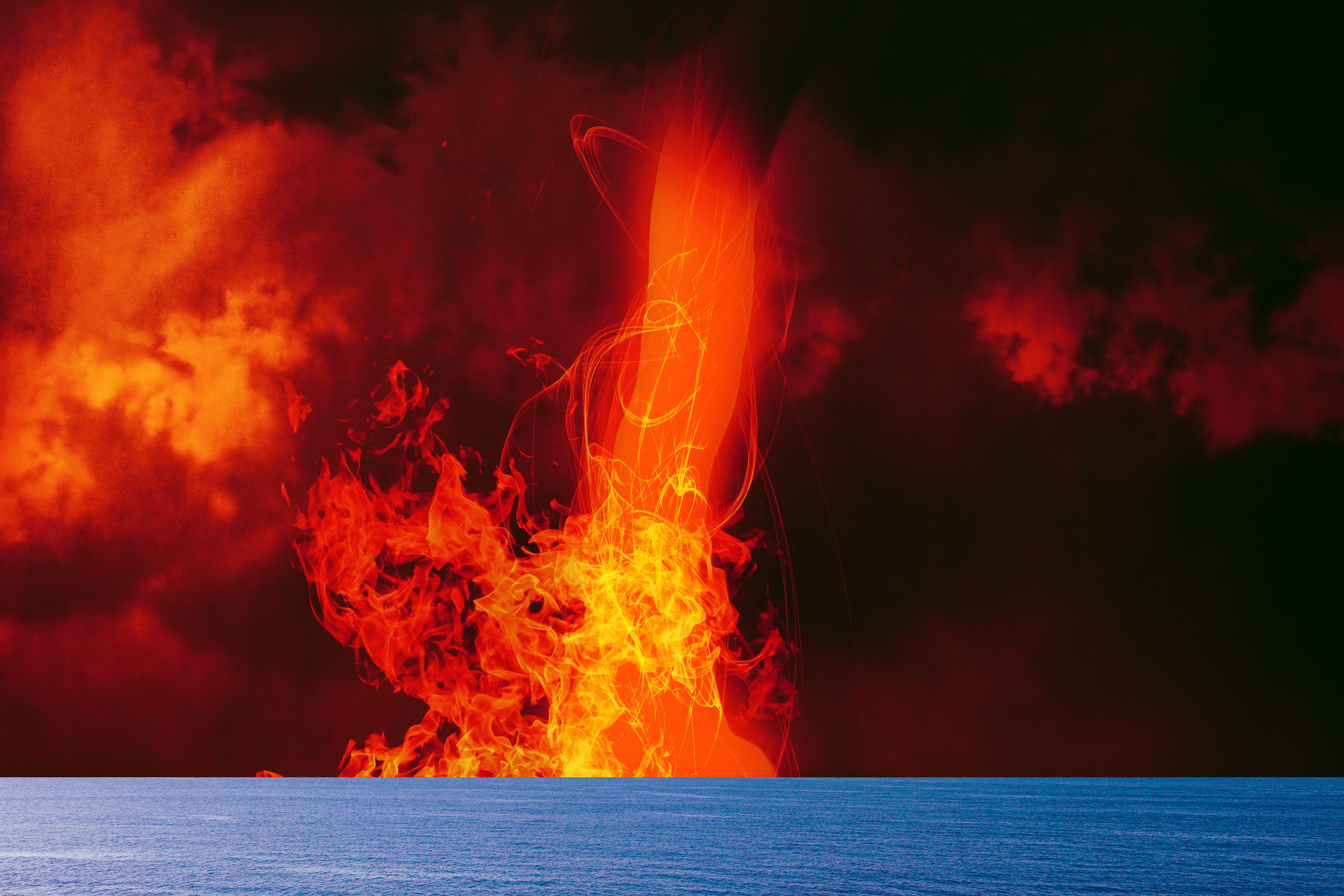
1. Fire Whirls
Imagine a tornado made of flame.
Fire whirls—sometimes called fire tornadoes—form when intense heat from a wildfire or volcanic eruption causes air to rise rapidly. As hot air ascends, it can begin to rotate if winds are turbulent or if temperature differences create shear. The rotating column tightens, drawing flames, ash, and embers into a spinning vortex.
Unlike true tornadoes, fire whirls are driven primarily by heat rather than supercell thunderstorms. However, under extreme wildfire conditions, they can grow enormous, with towering columns of rotating fire reaching hundreds of meters high.
In 2018, during California’s Carr Fire, a fire whirl exhibited tornado-like intensity, even producing EF3-level damage. That event demonstrated that under rare circumstances, fire-generated vortices can rival conventional tornadoes in destructive power.
The physics behind them is rooted in convection and angular momentum. Rising hot air creates low pressure at the base, pulling surrounding air inward. If that inflowing air has rotational motion, conservation of angular momentum intensifies the spin—just as a figure skater spins faster when pulling in their arms.
Fire whirls remind us that heat is not passive. Under the right conditions, it dances.
2. Ball Lightning
For centuries, sailors and storm-watchers have reported glowing spheres drifting through the air during thunderstorms. Sometimes they float silently. Sometimes they hiss. Occasionally, they explode.
Ball lightning remains one of the most mysterious atmospheric phenomena ever described.
Unlike ordinary lightning—which lasts microseconds and travels in jagged channels—ball lightning appears as a luminous orb, typically the size of a grapefruit, persisting for several seconds.
Scientists long dismissed it as folklore. But modern documentation, including rare video evidence, confirms its existence.
The precise mechanism remains debated. Proposed explanations include plasma formations stabilized by magnetic fields, vaporized silicon from soil interacting with oxygen, or microwave radiation trapped in spherical plasma cavities.
Laboratory experiments have produced ball-like plasma structures, lending credibility to certain models. However, no single theory fully accounts for all reported characteristics.
Ball lightning sits at the boundary between atmospheric electricity and plasma physics—a reminder that even in well-studied thunderstorms, nature still holds secrets.
3. Mammatus Clouds
Sometimes the sky appears to sag.
Mammatus clouds form as pouch-like protrusions hanging from the underside of larger cloud formations, often cumulonimbus clouds associated with thunderstorms.
Unlike most clouds, which rise due to convection, mammatus formations involve sinking air. Ice crystals and precipitation in the upper cloud layers cool the air beneath them. As this cooled air becomes denser, it sinks in bulbous pockets, creating the characteristic lumpy underside.
The name comes from the Latin word for “breast,” describing their rounded shape.
Though visually dramatic—sometimes glowing orange or purple at sunset—mammatus clouds are not inherently dangerous. They often appear after severe storms have passed.
They are sculpted by turbulence, temperature gradients, and moisture variations. They look otherworldly, but they are a natural expression of atmospheric instability resolving itself.
4. Sprites and Blue Jets
Lightning does not always strike downward.
High above thunderstorm clouds, strange red flashes known as sprites can erupt into the upper atmosphere. Even higher, narrow blue jets shoot upward from cloud tops toward the stratosphere.
These phenomena, collectively known as transient luminous events, occur in the mesosphere and lower ionosphere.
Sprites appear as branching red tendrils, sometimes extending up to 50 kilometers above storms. They are triggered by powerful positive cloud-to-ground lightning strikes that alter the electric field in the upper atmosphere.
Blue jets are narrower and more conical, rising from thundercloud tops.
These events were only conclusively photographed in 1989, despite likely occurring throughout Earth’s history.
They reveal that thunderstorms are not confined to the troposphere. Electrical processes extend upward into near-space, connecting weather to the edge of the atmosphere.
The sky is layered—and sometimes, lightning climbs.
5. The Green Flash
At sunset or sunrise, a brief emerald spark may appear on the horizon. For a second or two, the upper edge of the Sun glows green before vanishing.
This is the green flash.
The phenomenon arises from atmospheric refraction. As sunlight passes through Earth’s atmosphere, different wavelengths bend by slightly different amounts. Blue and green light are refracted more strongly than red.
Near the horizon, atmospheric scattering removes much of the blue light. Under very clear conditions—often over the ocean—the remaining refracted green light can momentarily become visible at the Sun’s upper rim.
The effect is fleeting and requires specific viewing conditions. But it is entirely real, governed by optics and atmospheric density gradients.
The Sun does not change color. Our atmosphere performs the illusion.
6. Catatumbo Lightning
In northwestern Venezuela, at the mouth of the Catatumbo River where it meets Lake Maracaibo, lightning strikes with astonishing frequency.
Known as Catatumbo lightning, this phenomenon can produce thousands of lightning flashes per night during peak season.
Warm, moist air from the lake rises and collides with cool air descending from the Andes Mountains. The resulting instability fuels persistent thunderstorms.
The geography acts as a lightning factory.
Catatumbo lightning is so consistent it has historically served as a natural lighthouse for sailors.
It demonstrates how local topography, temperature contrasts, and humidity can conspire to create near-continuous atmospheric electricity.
7. Polar Stratospheric Clouds
In the bitter cold of polar winters, rare clouds form in the stratosphere at altitudes of 15 to 25 kilometers.
These polar stratospheric clouds shimmer in pastel colors—pink, turquoise, pearl—earning them the name “mother-of-pearl clouds.”
They form only when temperatures drop below approximately −78°C, allowing nitric acid and water vapor to crystallize.
Though beautiful, they play a role in ozone depletion. Chemical reactions on their icy surfaces convert chlorine compounds into forms that destroy ozone when sunlight returns in spring.
These clouds remind us that beauty and consequence can coexist in the atmosphere.
8. Thundersnow
Snow falling silently is familiar. Snow falling with thunder is astonishing.
Thundersnow occurs when strong upward motion in a winter storm produces convective instability similar to that in summer thunderstorms.
Lightning and thunder accompany heavy snowfall.
Because snow muffles sound, thunder during thundersnow often sounds softer and more eerie than in warm-weather storms.
It is rare because cold air is generally less conducive to vigorous convection. But when conditions align—especially in powerful nor’easters or lake-effect storms—electric winter skies can emerge.
Snow can roar.
9. Lenticular Clouds
Sometimes mountains wear hats.
Lenticular clouds are smooth, lens-shaped formations that form when stable, moist air flows over mountain ranges. As air rises over the terrain, it cools and condenses. On the leeward side, it descends and warms, creating a standing wave pattern in the atmosphere.
At the crests of these atmospheric waves, clouds form and remain stationary—even as wind flows rapidly through them.
Pilots often avoid these areas due to turbulence.
Their smooth, saucer-like shape has frequently been mistaken for unidentified flying objects. But they are entirely terrestrial, shaped by airflow and condensation.
Mountains sculpt the sky as surely as wind sculpts sand.
10. Dust Devils
On hot, dry days, small spinning columns of air can rise from the ground, lifting dust and debris into swirling spirals.
Dust devils are caused by intense surface heating. When ground temperature becomes significantly hotter than the air above it, convection begins. Rising warm air can start rotating if there is slight wind shear or local turbulence.
Unlike tornadoes, dust devils form in fair weather and are usually much weaker.
They can reach impressive heights, though, sometimes over a kilometer tall.
Dust devils even occur on Mars, where the thin atmosphere still supports convective vortices.
Heat alone can twist the air into motion.
11. Brinicles
Beneath polar sea ice, something extraordinary can happen.
When extremely cold, salty water drains from forming sea ice into the ocean below, it creates a descending plume of super-cooled brine. As this plume sinks, it freezes the surrounding seawater, forming a hollow ice tube downward into the depths.
This structure is called a brinicle—sometimes nicknamed an “ice finger of death.”
As it grows downward, it can freeze slow-moving sea creatures in its path.
Brinicles demonstrate how phase changes, salinity gradients, and thermodynamics interact in extreme environments.
Weather and oceanography intertwine even beneath the ice.
12. Atmospheric Rivers
Sometimes the sky becomes a river.
Atmospheric rivers are long, narrow corridors of concentrated water vapor in the atmosphere. They can transport as much water as major terrestrial rivers—except in vapor form.
When these moisture-laden systems make landfall, especially along mountainous coastlines, they release heavy rainfall or snowfall.
In California, atmospheric rivers are responsible for both drought relief and catastrophic flooding.
They are invisible from the ground but detectable by satellites.
Water does not simply evaporate and fall. It travels in massive airborne currents spanning thousands of kilometers.
13. Supercells and Mesocyclones
Among thunderstorms, supercells are giants.
These storms contain rotating updrafts called mesocyclones. Wind shear—changes in wind speed and direction with height—causes horizontal rotation in the atmosphere. Strong updrafts tilt this rotation vertically, creating a spinning core.
Supercells can produce large hail, intense rainfall, and the most powerful tornadoes.
They are long-lived and highly organized compared to ordinary thunderstorms.
Within their structure lies complex fluid dynamics—rotation, buoyancy, condensation, latent heat release.
A supercell is not chaos. It is organized violence.
14. Ice Circles
In slow-moving rivers during cold winters, large circular ice discs sometimes form and rotate slowly.
These ice circles can grow several meters wide.
They form when chunks of ice become trapped in circular eddies. As they rotate, collisions and freezing smooth their edges into near-perfect circles.
It is a dance between fluid motion and freezing water.
Nature occasionally prefers symmetry.
15. Noctilucent Clouds
High above the Earth, at the edge of space, faint electric-blue clouds sometimes glow after sunset.
Noctilucent clouds form in the mesosphere at altitudes around 80 kilometers. They are composed of ice crystals forming around dust particles, possibly including micrometeoroids.
They are visible only when illuminated by the Sun from below the horizon, while the lower atmosphere remains in darkness.
These are the highest clouds in Earth’s atmosphere.
Their formation may be linked to atmospheric changes, including rising methane levels that produce additional water vapor at high altitudes.
They are delicate and ghostly—clouds that shimmer at the threshold of space.
The Sky as a Living Laboratory
Weather is not random chaos. It is physics in motion—thermodynamics, fluid dynamics, electromagnetism, phase transitions, and radiative transfer unfolding above us every day.
Each of these fifteen phenomena arises from understandable physical principles. Yet understanding does not diminish wonder.
The atmosphere is thin—only about 100 kilometers deep compared to Earth’s 12,742-kilometer diameter. And within that fragile shell, temperature differences, solar radiation, Earth’s rotation, water vapor, and topography combine to produce an astonishing range of behavior.
The sky is not empty. It is alive with movement.
Awe and Understanding
To stand beneath mammatus clouds, to witness a green flash, to hear thunder during snowfall, or to see sprites dancing above a storm is to realize that Earth is not static.
It is dynamic.
These phenomena are not miracles. They are not myths. They are expressions of natural laws—sometimes rare, sometimes violent, sometimes gentle, always intricate.
And perhaps that is the most mind-blowing realization of all.
We live beneath a ceiling of invisible currents, electric tension, and shifting pressure fields. We breathe air shaped by planetary rotation and solar energy. We are sheltered by a dynamic, ever-changing system that is at once delicate and immense.
Weather is not merely something that happens to us.
It is a continuous cosmic performance—written in wind, painted in light, and powered by the physics of a star 150 million kilometers away.
Look up.
The sky is stranger than you think.