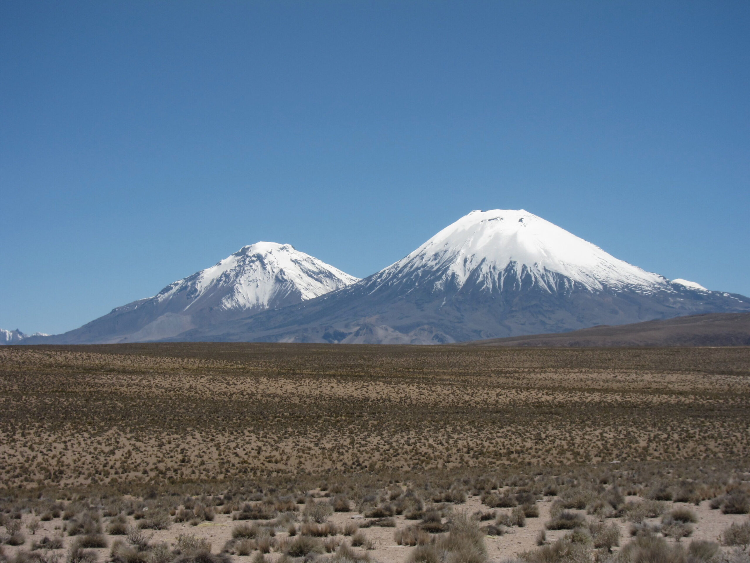
More than 21 million years ago, a huge volcanic eruption spread a thick blanket of ignimbrite across the western Central Andes, burying a landscape shaped by rivers. The buried terrain could not have been very steep if the volcanic deposit was able to cover it completely. That simple geometric constraint gives researchers a way to work backward from the ancient volcanic surface to estimate how quickly the rocks beneath it were rising before the eruption.
Ignimbrites are volcanic deposits produced by fast-moving pyroclastic density currents. The largest examples can spread over enormous areas and leave behind broad surfaces with relatively gentle slopes. These deposits can be more than a kilometer thick in places, with greater thickness over ancient valleys than over ridges. Their upper surfaces commonly slope gently away from the eruption source.
That geometry creates an unusual geological constraint. If an ignimbrite came from a higher source and flowed across an existing mountain landscape, its surface could completely cover that landscape only if the buried terrain was no steeper, on a regional scale, than the volcanic surface itself. If the underlying mountain range had a steeper overall slope, higher parts of the landscape would be expected to rise above the deposit.
The researchers used that relationship to ask how much rock uplift could have occurred while the buried landscape was developing. Rather than trying to recover an instantaneous uplift rate from one location, their approach estimates the range of uplift rates that could have produced the landscape over the time it took rivers to develop its relief before the eruption.
The key case is the Cardones ignimbrite on the western side of the Central Andes. It was deposited about 21.9 million years ago and has an estimated volume greater than 1,260 cubic kilometers. The deposit is part of the regionally extensive Oxaya Formation and is thought to have come from the nearby Lauca Caldera. Its original surface had a slope of about 1.5° ± 0.3°, after accounting for later folding and tilting.
That gentle surface effectively places an upper limit on the regional slope of the landscape that was buried beneath it.
Rivers provide the link to rock uplift
To turn that geometric limit into an estimate of uplift, the researchers modeled how river networks respond to rock rising beneath them.
They used a version of the stream-power model of river erosion. In this framework, rock uplift raises the river channel while erosion lowers it. The balance between those processes depends partly on the drainage area, channel slope and a parameter called erodibility, which represents how efficiently the landscape is eroded under the modeled conditions.
One useful measure in the model is channel steepness. After accounting for the increase in drainage area downstream, channel profiles can be transformed into a form called a χ-plot. The resulting channel-steepness value provides a scale-normalized measure of fluvial relief. Under the model, channel steepness increases with rock uplift rate and decreases with erodibility. Thus, for the same erodibility, faster uplift produces steeper channels and greater relief.
The researchers deliberately kept the model relatively simple. Their two-dimensional landscape model represented river incision but not hillslope processes. They noted that fluvial relief generally makes up at least 80% of range-scale relief in nonglaciated mountain belts, and that leaving out hillslope processes means the modeled fluvial relief and channel steepness are likely to represent maximum values.
They ran 560 synthetic landscapes on a roughly 22.4-by-22.4-kilometer grid. Each simulation began with the same low-relief river network and then evolved under uniform rock uplift and erodibility until the landscape reached a steady state. Rock uplift rates ranged from 0.1 to 2 kilometers per million years, while erodibility ranged from 1 × 10⁻⁹ to 1 × 10⁻⁶ meters⁻¹ years⁻¹. The models used stream-power exponents of n = 2 and m = 1, giving a concavity of 0.5.
The modeling produced a remarkably simple relationship between the two measures of relief. Across the simulations, range-scale slope was linearly related to channel steepness:
SR = kₛₙ / 108.3
The relationship had an R² of 0.999.
For one modeled trunk river, a channel-steepness value of about 162 corresponded to roughly 1,000 meters of fluvial relief over about 18 kilometers of range-perpendicular distance. The total mountain-range relief was about 1,400 meters in that example because the range-scale slope also reflects tributary networks and the geometry of drainage divides, rather than the trunk river alone.
The buried Cardones landscape had to be relatively gentle
The 1.5° surface slope of the Cardones ignimbrite means the underlying landscape must have had a range-scale slope of 1.5° or less if it was completely buried. The model therefore limits the possible combinations of rock uplift and erodibility to those capable of producing landscapes within that slope.
Erodibility is important because a rapidly rising landscape can nevertheless remain relatively subdued if erosion is sufficiently efficient. Conversely, low erodibility allows relief to grow more readily under uplift. The researchers therefore examined published erodibility estimates and normalized them to the stream-power parameters used in their models. Values reported for several natural landscapes span roughly 2 × 10⁻⁹ to 1 × 10⁻⁸ meters⁻¹ years⁻¹, with some settings showing broader variation.
For northern Chile, the researchers adopted an erodibility range of about 1 × 10⁻⁹ to 1 × 10⁻⁸ meters⁻¹ years⁻¹ as a conservative upper bound for pre-eruption conditions. Their reasoning included evidence for arid conditions in the Central Andes during the Miocene and the persistence of the ignimbrite deposits themselves. Rivers have not completely removed the deposits or reexcavated the pre-eruption landscape even over tens of millions of years, while some knickpoints in the western Andes are at least 11 million years old.
Within that adopted erodibility range, landscapes gentle enough to have been completely buried beneath the Cardones ignimbrite require rock uplift rates below 0.26 kilometers per million years. The corresponding modeled landscapes have channel steepness around 160.
The result is an upper bound rather than a precise reconstruction of one historical uplift rate.
Complex river histories do not make the limit disappear
The researchers also tested whether their constraint would hold if the ancient rivers had not evolved under perfectly steady conditions.
Real landscapes can contain knickpoints and changes in slope produced by changes in uplift or erosion. To explore those possibilities, the researchers generated millions of synthetic river profiles with different combinations of concave and convex segments while keeping the maximum relief fixed. They tested populations of three million randomized profiles for different geometric arrangements of knickpoints.
The randomized profiles showed that a complex, nonsteady river profile lying beneath the maximum steady-state profile has a mean channel steepness lower than that steady-state profile when the overall relief is conserved. Increasing the geometric complexity also reduced mean channel steepness.
That makes the steady-state landscape a conservative end member for estimating the maximum uplift rate compatible with the buried relief. In other words, allowing more complicated histories does not require the researchers to raise the uplift-rate ceiling obtained from the simplest model.
The geometry of the ignimbrite itself also matters. The method works best when the deposit forms an expansive surface that can be approximated by a single regional slope and when it thins predictably away from its source. Local variations in thickness can arise from interaction with the preexisting terrain, flow impoundment or ponding, but the researchers argue that these effects primarily alter local thickness rather than reversing the large-scale surface slope used in their analysis.
The timing of the landscape is part of the measurement
The uplift estimate is not tied to the instant when the Cardones eruption occurred. It represents the average rock uplift that could have acted during the period required for the buried landscape to develop.
To examine that timescale, the researchers ran additional models on a larger 100-by-50-kilometer domain, more representative of the scale of Andean river systems. They measured the time required for a landscape to reach 95% of its expected steady-state relief rather than waiting for complete mathematical stability.
The simulations showed that landscape adjustment becomes slower when erodibility and rock uplift rates are lower and when the final range-scale slope is higher. In one modeled case using an erodibility of 4 × 10⁻⁹ meters⁻¹ years⁻¹ and a rock uplift rate of 0.1 kilometers per million years, the modeled landscape reached a 1.5° range-scale slope at 95% steady state in about 14 million years. The researchers describe that 14-million-year interval as a minimum time required for steady uplift at those conditions to generate the modeled landscape.
This distinction is important because the uplift rate inferred from the buried landscape integrates over a different timescale from many other geological estimates.
The authors compare their maximum of 0.26 kilometers per million years with low-temperature thermochronometric estimates from the western Andean margin, which indicate time-averaged rock uplift rates below 0.2 kilometers per million years over roughly the past 50 million years. They emphasize, however, that the two types of estimates cannot be directly compared because they average over different periods.
The authors also note that their shorter-term estimate is consistent with longer-term geological constraints. They interpret that consistency as evidence for a relatively steady tectonic history since the Incaic orogeny and argue that the later Miocene-Pliocene Quenchua orogeny was largely confined to Peru rather than producing a measurable effect in northern Chile.
The method is selective about the landscapes it can preserve
The study’s interpretation extends beyond the Cardones deposit. The researchers argue that large, regionally extensive ignimbrites do not preserve arbitrary snapshots of mountain-building history.
A landscape developing under rapid or strongly varying uplift is less likely to remain low-relief over the distances required for complete burial by a gently sloping ignimbrite. A landscape shaped by relatively slow or spatially uniform uplift has more opportunity to develop the subdued relief that can be covered by such a deposit.
That does not mean a low-relief buried landscape has only one possible cause. The researchers identify several possibilities. Low relief can result from low rock uplift rates accompanied by low erosion rates, high erodibility associated with easily eroded bedrock, or high precipitation rates. Their Central Andes interpretation depends on the separate constraints they use for erodibility and regional conditions.
The approach also has conditions that limit how directly it can be transferred to other places. The researchers say their framework is most readily applicable where there is good reason to expect river concavity values near 0.5. More precise values for the stream-power exponents could improve its transferability. They also note that further landscape modeling could help clarify how eruption discharge, preexisting topographic roughness, ignimbrite thickness and runout interact, as well as improve estimates of paleotopography and post-eruption erosion.
For the Cardones ignimbrite, however, the central geometric constraint remains straightforward: a volcanic surface that slopes only gently away from its source could completely bury the pre-eruption landscape only if that landscape was similarly gentle on the regional scale. Combined with river-incision modeling and the adopted range of erodibility, that buried geometry places the maximum average Oligocene-Miocene rock uplift rate at 0.26 kilometers per million years.
The study was published in Science Advances.